Maps
Leer en EspañolMaps of Honduras – Official map of Honduras, Political and Administrative Division Map, Map of Ethnic Groups, Map of Protected Areas.
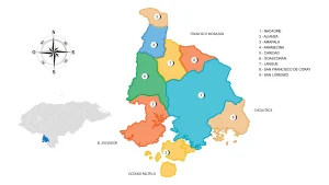
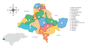
Map of the Department of Valle
The Department of Valle is located in the southern part of the country. It has a territorial area of 1,665 km².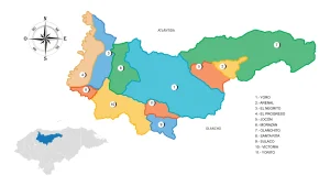
Map of the Department of Yoro
The Department of Yoro is located in the northwestern part of the country. It has a territorial area of 7,781 km².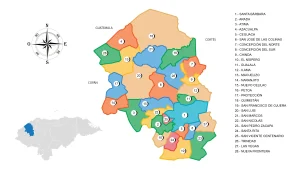
Map of the Department of Santa Barbara
The Department of Santa Barbara is located in the northwestern part of the country. It has a territorial area of 5,025 km².The Map of Honduras
The first general map of the Republic of Honduras at a scale of 1:500,000 was prepared by Dr. Jesús Aguilar Paz, approved by the Government through agreement number 689 of January 23, 1930.
A second improved and updated edition appeared in 1954, this geographical map filled for a long time an important gap in the cartographic information of the country, since there were no government agencies that satisfied such a need.
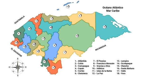
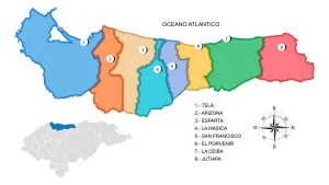
Map of the Department of Atlantida
Located in the northern part of the country on the coast of the Caribbean Sea or the Antilles, it is a narrow and fairly long strip of land in the northern sector and in the northeastern region of Honduras.
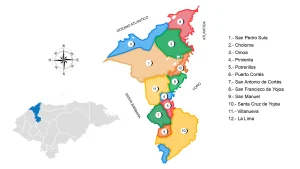
Map of the Department of Cortés
It was formed with the districts of San Pedro Sula and Santa Cruz, which belonged to Santa Bárbara.
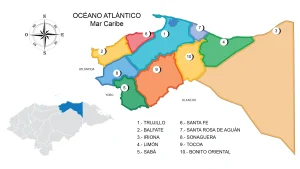
Map of the Department of Colon
When the first political territorial division was made in 1825, Colon was part of Yoro, until 1881.
Map of the Department of Comayagua
The Department of Comayagua is located in the central part of the country. It has a territorial area of 5,124 km².
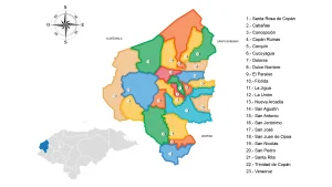
Map of the Department Copán
The Department of Copán is located in the western part of the country. It has a territorial area of 3,242 km².
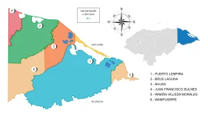
Map of the Department of Gracias a Dios
The Department of Gracias a Dios is located in the north with the Republic of Nicaragua. It has a territorial surface of 16,997 km².
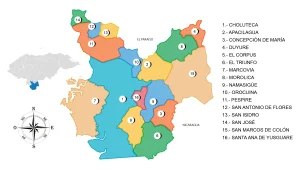
Map of the Department of Choluteca
The Department of Choluteca is located in the southern part of the country. It has a territorial area of 4,360 km².
Map of the Department of El Paraíso
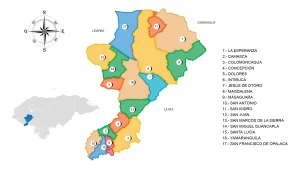
The Department of El Paraíso is located in the east of the country. It has a territorial area of 7,489 km².
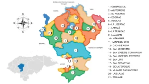
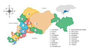
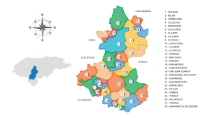
Map of the Department of Francisco Morazán
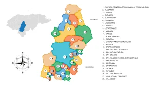
The Department of Francisco Morazán is located in the central part of the country. It has a territorial surface of 8,619 km².
Map of the Department of Intibucá
The Intibucá Department is located in the western part of the country. It has a territorial area of 3,123 km².
Map of the Department of the Bay Islands
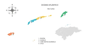
The Department of the Bay Islands is located in the Caribbean Sea or the Antilles (Insular department) in the north of the country. It has a territorial area of 236 km².
Map of the Department of La Paz
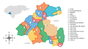
The Department of La Paz is located in the southwestern part of the country. It has a territorial surface of 2,525 km².
Map of the Department of Lempira
The Department of Lempira is located in the west of the country. It has a territorial area of 4,228 km².
Map of the Department of Ocotepeque
The Department of Ocotepeque is located in the westernmost part of the country. It has a territorial area of 1,630 km².
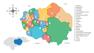
Map of the Department of Olancho
The Department of Olancho is located in the northeastern part of the country. It has a territorial surface of 23,905 km².
Map of the Department of Santa Bárbara
The Department of Santa Bárbara is located in the northwestern part of the country. It has a territorial area of 5,025 km².
Map of the Department of Valle
The Department of Valle is located in the southern part of the country. It has a territorial area of 1,665 km².
Map of the Department of Yoro
The Department of Yoro is located in the central-northern region of the country. It has a territorial surface of 7,781 km².
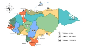
Customs Map of Honduras
Honduras will soon have another air terminal in Palmerola in the Department of Comayagua.

Health Regions of Honduras (Map)
Map of the 20 Health Regions of Honduras Honduras; 18 of them departmental and 2 Metropolitan
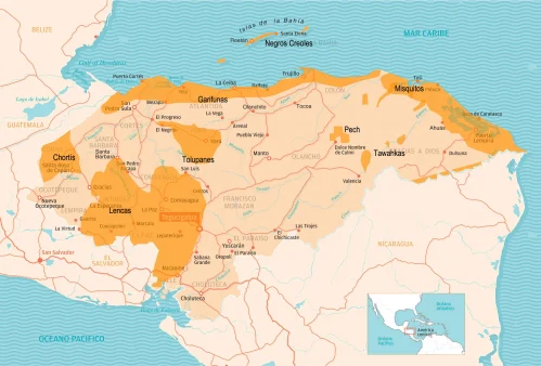
Map of Ethnic Groups and Indigenous Groups in Honduras
Geographical distribution of the different ethnic groups or indigenous groups throughout the Honduran territory.


