City and Municipality of San Pedro Sula
San Pedro Sula is the second largest city in Honduras and the administrative capital of the Department of Cortes. Among other signs of its importance, the city is home to the country’s most important industrial companies, which is why it is also known as the industrial capital of the country.
San Pedro Sula was founded on June 27, 1536, under the name of San Pedro de Puerto Caballos by the Spanish conquistador Pedro de Alvarado. San Pedro Sula is the city with the lowest unemployment rate in the country and the highest number of bilingual individuals in Central America, thanks to which it has experienced significant economic growth with call centers.
This city is flanked by the Merendón Sierra and is located in the southwest corner of the extensive and fertile Sula Valley, a region that generates approximately 50 percent of the Gross Domestic Product (GDP) and 60 percent of the nation’s exports.
Origin of its name: San Pedro, named after one of the disciples for religious reasons, and Sula, because it is located in the valley of the same name.

General Information about San Pedro Sula
- Date of establishment: June 27, 1536
- Date as Municipal Seat: July 4, 1893
- Land area: 898.60 km2
- Elevation: 22 meters above sea level
- Patron Saint Fair: June 29, feast day of Saint Peter and Saint Paul
- Administrative Code (Geocode): 0501
- Villages: 52
- Hamlets: 246
History
See more about the History of San Pedro Sula San Pedro Sula was founded on June 27, 1536, under the name of San Pedro de Puerto Caballos by the Spanish conquistador Pedro de Alvarado.
Initially, the town was established in the indigenous village of Tholoma, to the north of the current city and very close to Puerto Cortés.
Village of San Pedro
Due to its proximity to the port of Omoa, the village of San Pedro was attacked and plundered by European pirates who landed in that port. For this reason, the Spanish authorities were forced to relocate the village on more than one occasion.
The village of San Pedro was rich in gold and for decades it was a refuge against the greed of English, French, and Dutch pirates. It suffered a virtual abandonment in the year 1600 and was on the verge of disappearing 60 years later. From 1660 to 1860, San Pedro was relegated to the status of a village and a smugglers’ camp.
Its population survived thanks to a group of cattle ranchers who harvested their own food and traded sarsaparilla, which was used as medicine at that time. At that time, their houses were made of adobe, with thatched roofs and dirt floors. The village of San Pedro began to progress with the resumption of commercial traffic through Omoa in the mid-19th century. The village retained its municipal status and was among the councils that declared Honduras independent from Spain in 1821.
Departmental Headquarters
According to a decree issued on June 28, 1825, by the First Honduran Congress, San Pedro Sula became part of Santa Bárbara, dividing the Honduran territory into 7 departments: Comayagua, which was the capital of Honduras until October 30, 1880, Santa Bárbara, Tegucigalpa, Gracias, Olancho, Choluteca, and Yoro. On July 4, 1893, General Domingo Vásquez, the president of the Republic, created the Department of Cortés and designated San Pedro Sula as the departmental capital. For over two centuries since its founding, the population growth of San Pedro Sula was quite slow. Currently, San Pedro Sula has the highest population growth rate in Honduras. The economic development achieved as a result of the arrival of multinational banana companies in the early 20th century and the subsequent establishment of industrial parks (ZIP) in the Sula Valley greatly contributed to the population increase of San Pedro Sula.
Toponymy
It was founded under the name of San Pedro de Puerto Caballos as established by the scribe Gerónimo de San Martín. The addition of Puerto Caballos was due to its proximity to that port, now called Puerto Cortés.
«After Alvarado’s death in 1541, the Villa de San Pedro Sula is mentioned, and it is not known if the addition of Sula was an official disposition,» says historian and member of the Honduran Academy of Geography and History, Carmen Fiallos, in her book Los municipios de Honduras (1989). Likewise, Fiallos says, «It is unknown whether the Villa de San Pedro was formally granted the title of City.»
The word «Sula,» according to Alberto de Jesús Membreño (writer and former president of Honduras) in his book Nombres geográficos indígenas de la república de Honduras (1901), «means ‘abundance of quails’ in Mexican» and «is composed of çolin, quail, and la abundance.»
According to Pedro Aplícano Mendieta, author of Los mayas: un pueblo elegido (1971), «Zula means lily in Maya or region where this plant abounds.» According to Aplícano, «San Pedro had to add Sula, just as in El Salvador the town of San Pedro added Perulapan, which was the indigenous toponym of the region.»
What is established is that the word «Sula» is an abbreviation of the word «Usula» (Valley of Birds), the ancient name of the valley where San Pedro is currently located, and «whose etymological features are as follows: Sula, Zula, Usula, Sola, Solía, from Zolin or Zulin,» according to Carmen Fiallos.
Location
San Pedro Sula is located in the western portion of the Sula Valley, in the northern territory of Honduras and in the Cortés Department, serving as its political capital since July 4, 1893.
Ver en Google Maps
Limits
- North: municipalities of Choloma and Omoa;
- South: with the Chamelecón River and the municipalities of San Manuel and Villanueva;
- East: municipality of La Lima;
- West: with the Merendón Mountain and the municipality of Quimistán (Santa Bárbara).
Topography
The city has a flat topography with a slight inclination towards the East. «Due to its topographic characteristics, San Pedro Sula can be divided into two zones: (1) The Reserve Zone of the Merendón Mountain Range, which occupies 395 km2 and the western slope, and the zone of the Sula Valley. In the Merendón zone, there are the water-producing sources for the city’s supply and part of the Cusuco National Park ecosystem.»
«The western slope is also part of the Merendón Mountain Range and covers an area of 230.3 km². These zones have a relief that varies from hilly to steep, with altitudes of up to 2,242 meters above sea level at the highest point of Cusuco and a minimum of 200 meters above sea level. In the Merendón basins, 70% of the slopes are steeper than 50%, 27% have slopes between 30% and 50%, and only 2.5% have slopes less than 30%.»
The Sula Valley zone comprises the city of San Pedro Sula and the surrounding area. In this zone, approximately 65% is flat with slopes of less than 10%, although there are some high reliefs such as Chotepe, Campisa, and Tres Pasos hills. Various types of soil are found in this area, as well as the main agricultural soil areas in the northern zone of Honduras. Therefore, these soils are suitable for both agriculture and the cultivation of sugarcane and banana plantations.
San Pedro Sula is located in an excellent geographic position in relation to the most important cities in the country. The capital, Tegucigalpa, is 244 km (152 miles) away from San Pedro Sula. Puerto Cortés, the country’s most important port and in Central America, is only 58 km (36 miles) to the north. The tourist cities of Tela and La Ceiba are located at distances of 62 km (39 miles) and 203 km (126 miles) respectively. Santa Rosa de Copán, near the border with Guatemala, is 160 km (99 miles) away.
Climate
San Pedro Sula, located in the lowlands, often has a suffocating climate. It can become extremely hot and humid. The dry season, or summer in San Pedro Sula, extends from December to April. The months of March and April are the hottest and driest months in the city.
The rainy season or winter in San Pedro Sula extends from May to November, which helps to slightly cool down the temperature. The months of August are generally the wettest.
Hydrography
Rivers
- Naco River, Piedras River, Bermejo River, Armenia River, Cusuco River, Chiquito River, San Ildefonso River, San Carlos River, Cortesito River
Creeks
- Santa Elena Creek, San Bartolo Creek
Lakes
- Jucutuma Lagoon, El Carmen Lagoon
Orography
- Omoa Range, San Ildefonso Mountain
Flora and Fauna
Flora
San Pedro Sula has a great diversity of flora. Just a few kilometers from the city is the Cusuco National Park, a cloud forest of enormous biodiversity and scenic beauty. It was declared a protected area in 1987 by the Honduran parliament under legislative decree 87-87. Walking along its trails allows for the observation of lush flora and fauna.
The park is located in the Merendón Sierra. It consists mostly of cloud forest between 1500 and 2450 meters above sea level. The area has high precipitation and an average temperature of 19 °C. It is also characterized by almost constant mist and drizzle.
The park is composed of a buffer zone covering an area of 222.23 km² and a core zone of approximately 72 km². The park is open to visitors who can engage in various activities such as hiking, camping, visiting waterfalls, bird watching, etc.
Fauna
In the valley, rich in tropical vegetation, there is an abundance of Cusucos (armadillos), Tacuacines (opossums), Iguanas, Monkeys, a wide variety of Birds and Snakes, Deer, Wild Boars, and Jaguars.
Population
San Pedro Sula has the highest population growth rate in Honduras, despite having had a fairly slow start since its foundation in 1536. Darío Euraque indicates that the Spanish and mestizo population during the colonial period was 20 in 1582, 70 in 1714, 357 in 1789, and 500 in 1801.
The economic development achieved as a result of the arrival of multinational banana companies in the early 20th century greatly contributed to the population increase of San Pedro Sula. In the year 1900, the population reached a total of 5,000 inhabitants. Ten years later, the city had 10,000 inhabitants, and a little over 21,000 by 1949.
Towards the end of the 20th century and the beginning of the 21st century, the population growth of San Pedro Sula was due to the establishment of industrial parks (ZIP) in the Sula Valley, which generated «considerable expansion» according to a study conducted by the San Pedro Water and Sanitation Project in 2001. According to data from the Municipal Statistical Research Directorate (DIEM), in 1999 San Pedro Sula had reached a population of 515,206 inhabitants (15% of the urban population) and 538,100 by 2004.
The current population data for San Pedro Sula (2010-2012) varies slightly. According to figures provided by the National Institute of Statistics (INE), there are 719,447 residents in San Pedro Sula. Meanwhile, the Municipal Statistical Research Directorate (DIEM) recorded 1,024,182 people in 2010.
The head of DIEM, René Landaverde, states that «according to DIEM data, only 814,000 inhabitants are native (residents) of San Pedro Sula, and the rest is floating population that has settled in the city for certain periods of time to seek work, study, or engage in business.»
«The population growth of San Pedro Sula is notably reflected in the fact that the urban area has shown a 112% increase in its surface area since 1992 when it was 135.87 square kilometers. It now has a size of 287.536 square kilometers. This has led to a reduction in the rural area by approximately 22% of its surface area from 18 years ago when it had 701.7 square kilometers and now only comprises 550.0552 square kilometers.»
«It is estimated that in 2008 there were 5,500 families living in the slums, and at the moment it is estimated that there are about 7,000. Based on projections, it is estimated that by 2012 there will be about 10,000 families settled in these areas, which will increase the poverty belt surrounding the industrial city. The people who have migrated to the slums are mostly from the departments of Santa Bárbara, Copán, and Lempira.»
Currently, San Pedro Sula is divided into eight sectors. The northeast suburban sector (6) represents 28.6% of the total population of the city. In the east suburban sector (5), 21% of the population resides, and the southeast sector represents 14.5%. Meanwhile, the least populated sector is the southwest, accounting for only 2.8% of the total population.
Economy
The municipality of San Pedro Sula is the most important industrial zone in the country. More than 20 industrial sectors generate a high percentage of the income for the people of San Pedro Sula. These include the pharmaceutical industry, call centers, rubber, soft drinks and beers, textiles, cotton, printing, plastics, tobacco, cosmetics, serums, meat processors, concrete, soap, paints, among others.
Agriculture
- Bananas, Citrus fruits, Sugarcane, Coffee, Coconuts, Papayas, Pineapples, Cashews, Vegetables
Livestock
- Poultry, Cattle, Horses, Goats, Sheep
Commerce
The city has more than twenty banking institutions, half of which have been established in the last decade of the 20th century. Insurance companies have also expanded. Commerce has been flourishing, and modern shopping centers (referred to as «malls» by the residents) have been developed with great success, including Multiplica, Mega Plaza, Metro Plaza, City Mall, and Mall Galerías del Valle.
«To this list, other activities are added such as industrial paint application, health clinics, clinical laboratories, photographic laboratories, automotive workshops, and body and paint workshops. Most industries are located in the central zone, within the peripheral ring, with some industries along the corridors to the south, east, and north.» «Small and medium industries show a central location, anticipating significant discharge from clinics, mechanical workshops, body and paint workshops, and photographic workshops.»
In recent years, the service sector has grown enormously. The city has more than twenty banking institutions. Half of these were established in the last decade of the 20th century. In addition, insurance companies have increased, and with the construction of modern shopping centers such as Megaplaza, Metroplaza, City Mall, Mall Galerías del Valle, Plaza Pedregal, Plaza Santa Mónica, Plaza Moderna, among others, commerce has expanded. Another growing service sector is healthcare, with hospitals equipped with advanced technology, as well as private clinics.
Furthermore, the training of existing employees is another concern of business organizations such as the Chamber of Commerce and Industry of Cortés (CCIC) and the Honduran Maquiladores Association (AHM), which annually sign contracts with the Professional Training Institute (INFOP) to guide and reinforce their employees in specific areas. Facussé agrees with Reina and states that «San Pedro Sula will be a city of service.»
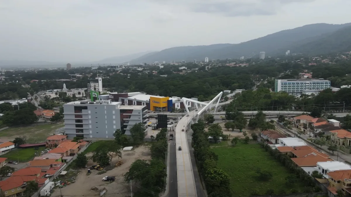
Infrastructure
In the city of San Pedro Sula, the tallest building is the «TORRE PANORAMA LIFE» with a height of 102 meters.
Transportation
San Pedro Sula, with an urban population close to one million people, is the administrative capital of Cortés department. «Among other signs of its importance, it is home to the largest industrial companies in the country.» Additionally, the city is very close to Puerto Cortés, the most important port of entry and exit in Honduras. It also has «many large-scale agricultural complexes for export» and foreign currency generation.
For international and domestic flights, San Pedro Sula has the Ramón Villeda Morales International Airport. The airport is located 15 km east of the city and is the busiest airport in the country, even busier than the one in the capital, Tegucigalpa. Regularly, airlines such as LACSA, TACA, COPA, United, Delta, Spirit, Sosa, Easy Sky, AeroCaribbean, Avianca, American, Continental, and Iberia offer their services at this airport.
Flights to San Pedro Sula arrive from the following departure ports: Miami, Houston, New Orleans, New York, Los Angeles, San Francisco, Orlando, Mexico City, and Cancun. There are also excellent connections with Central American airlines through San Jose, Costa Rica; San Salvador, El Salvador; Panama City, Panama; and Guatemala City, Guatemala. There is daily service from Isleña Airlines to San Pedro Sula from Roatan, La Ceiba, and Tegucigalpa.
The city is connected to the main cities of the country through a well-developed road system. People who visit San Pedro Sula and decide to travel by road (bus) to other cities usually use the Metropolitan Bus Terminal, located 5 km south of the city. This terminal was designed to bring together all bus lines under one roof and thus alleviate some of the traffic congestion in the city.
For travelers considering renting a car, it is important to know that the city of San Pedro Sula is divided into 4 quadrants following the old Spanish system of city construction: Northeast, Southeast, Northwest, and Southwest. All streets are numbered, with avenues running from north to south and streets running from east to west. The center is marked by 1st Street. The most important commercial street is 3rd Avenue. In the city, you can find services from companies like Avis, Budget, Dollar, Hertz, and local rental companies. Most of them have offices at the airport, and there are usually some of them in hotel lobbies.
Public Health
San Pedro Sula has a number of important hospitals, including the Leonardo Martínez Hospital, Mario Catarino Rivas Hospital, CEMESA Hospital, etc. Additionally, the city has a good number of private clinics, the Military Hospital of San Pedro Sula, which exclusively serves military personnel, and the Honduran Social Security Institute Hospital, which provides healthcare services to insured individuals.
This city also has thirty Health Centers, of which 14 are managed by the municipality with an annual budget of over 25 million lempiras, invested in infrastructure maintenance and payment of medical and support staff.
To prevent the people of San Pedro Sula from having to go to state hospitals for medical care, the Honduran Ministry of Public Health has committed to quarterly supply of medications. In this way, it is expected that the city’s health centers will have what they need to provide good care to the population of San Pedro Sula and its surroundings.
«The health problems present in San Pedro Sula in relation to the environment can be of a toxic-chemical nature due to the ingestion by digestive or respiratory route of chemical compounds or of a biological nature that are generated by the lack of control of environmental pollution caused by industries and other activities carried out in the municipality.» «The most common diseases in San Pedro Sula are malaria, dengue, Chagas disease, gastrointestinal diseases, and respiratory diseases.»
Tourism
Museum of Anthropology and History
The Museum of Anthropology and History offers the public a glimpse into history, starting with the arrival of the Spanish in Honduran territory. The encounter of contrasting groups, the wars of conquest, the resulting cultural and racial mestizaje, the foundation of San Pedro, and the banana exploitation. The museum opened its doors to the public on January 25, 1994; it is a place that protects national heritage, educates, promotes culture, encourages research, and reinforces identity.»
«Daisy Fasquelle Bonilla» Museum
This is a place that pays tribute to Honduran painters. It was inaugurated on September 27, 2007, in honor of Daisy Fasquelle Bonilla, who distinguished herself through her tireless efforts in the development and promotion of history and national culture. Visits are available from Monday to Friday. School groups or other institutions are accommodated by appointment.
The collection displayed in this museum corresponds to painters from past generations and contemporary artists who represent the artistic work of Honduras. Although the exhibition is rotating, you can always appreciate the works of great masters such as José Antonio Velásquez, Álvaro Canales, etc., and contemporary painters such as Maury Flores, Santos Arzú Quioto, Allan Caicedo, Armando Lara, among others.
San Pedro Cathedral «San Pedro Apóstol»
The cathedral of San Pedro Sula, «San Pedro Apóstol,» is not only a symbol of the faith and devotion of the Catholic people of San Pedro Sula but also an icon of the city’s identity. The idea of building a cathedral emerged in 1941, but it was not until August 1949 that the foundation stone was laid by Monsignor José de la Cruz Turcios y Barahona, the Archbishop of Tegucigalpa.
On February 3, 1953, the crypt was blessed. The then-designated bishop, Monsignor Antonio Capdevila, the parish priest of the San Pedro Apóstol parish, the Pro-Cathedral Committee, and the Women’s Auxiliary Committee made this work possible in less than four years. Finally, on September 27, 1987, the cathedral was inaugurated and blessed with a Holy Mass presided over by the diocesan bishop, Monsignor Jaime Brufau Maciá.
Cusuco National Park
Cusuco National Park is located in the northwest of Honduras, just forty kilometers from San Pedro Sula and close to the border with Guatemala. It covers approximately 23,440 hectares, divided into 7,690 hectares of core zone and 15,750 hectares of buffer zone. With altitudes ranging from 1,600 to 2,300 meters above sea level, it is a true cloud forest, an island of forest among the mountains. The park preserves a rich biodiversity that makes it invaluable for connoisseurs, especially foreigners, who are its most frequent visitors.
Victoriano López School of Music
«The dream that the Honduran Victoriano López began in 1945 with the founding of the Music Academy, which later took his name, is now one of the most important breeding grounds for artists in the country. The first graduating class with a Bachelor’s degree in music graduated in 1975, and since then, the school has not stopped producing musicians capable of excelling worldwide. The curriculum includes teaching of instruments such as violin, viola, cello, double bass, piano, flute, clarinet, oboe, bassoon, French horn, and trumpet, as well as classes in music appreciation, composition, and music history.»
Nature Museum
The Nature Museum is a museum under the supervision of the Héctor Rodrigo Pastor Fasquelle Ecologist Foundation. This museum features exhibitions on the environment, biology of Honduras, and natural resources. It has a collection of preserved specimens of birds, mammals, and reptiles found in Honduran territory.
It has 24 exhibition rooms, including «The Portal of Paleontology,» which offers a glimpse into the geological eras of the planet, the «Climate Change Room,» which addresses one of the most dangerous topics for the survival of life on Earth, and «The Underwater Platform,» which showcases species of fish inhabiting the marine world. The facilities also include rooms dedicated to Ethnicities, Ecology, Extinct Species, and Vertebrates, among others, which will expand your knowledge.
Other places of interest
They include: The Sampedrano Casino, located on Morazán Boulevard, the Sampedrano Cultural Center, located between 2nd and 3rd streets N.O., the Municipal Tourism Institute, located between 2nd and 3rd streets S.O., the Honduran Arab Social Center, Zizima Water Park, Wonderland Water Park, the Sampedrano Theater, among others.
Culture
Juniana Fair
The Juniana Fair is the patronal fair of San Pedro Sula and is held in honor of its patron saint, ‘San Pedro,’ one of the Twelve Apostles of Jesus. This fair began in 1846 and has now become one of the best and largest events in Honduras. As its name suggests, this fair is celebrated for most of the month of June, ending on July 4th each year.
In the past, during the fair, games of chance and gambling, including roulette, were allowed… The famous dances… were held on the rooftop of the Municipal Palace, at the Sampedrano Casino, and at the Tropical Salon. The Usula orchestra and the América India with their marimbas were among the most popular of their time, and orchestras from El Salvador and Guatemala also came. Religious festivities were held in the Sampedrana Cathedral, while popular celebrations took place in Paz Barahona Park and on the third avenue or Commerce Street.
In the sports arena, football matches were held at the Francisco Morazán Stadium, where local teams played, including Marathón, España, Independiente, among others. National teams such as Sula and Hibueras from La Lima also participated. Additionally, teams from Central America were contracted, such as Tipografía Nacional from Guatemala, FAS and Águila from El Salvador, Saprissa, Sport Cartaginés, from Costa Rica, among others.
Currently, ‘The Juniana Fair’ is celebrated with colorful traditional parades, attractions such as mechanical games, fireworks shows, a variety of traditional Honduran food. Commercial activities take place at the Expocentro and AGAS venues, located in two opposite poles of the city. There, merchandise of all kinds, handicrafts, electronics, livestock, etc., are bought and sold.
On June 29th, the Grand Dance Carnival is celebrated, second in importance in the country, after the one held in the city of La Ceiba. The carnival takes place along the main avenue of the Circunvalación, where numerous hotels and restaurants are located. Visitors can enjoy the talent of musical groups, Garifuna dancers, and numerous typical dishes and beverages, among other things.
Climate
The climate in San Pedro Sula is humid tropical, with only two seasons: rainy and dry. The rainy season extends from April to September, and the dry season from October to March. The temperatures are very hot, ranging from 22 to 39°C. However, it is also affected by cold fronts that come from air masses from the North Pole. There are records of heat index reaching up to 43.5°C (in May 2010).
San Pedro Sula, located in the lowlands, often has an oppressive climate. The dry season, or summer in San Pedro Sula, extends from December to April. The months of March and April are the hottest and driest months in the city. The rainy season, or winter, in San Pedro Sula extends from May to November, which helps to slightly cool down the temperature. The months of August are generally the wettest.
Sports
In the sports history of San Pedro Sula, the successful organization of the sixth Central American Sports Games stands out. These were held in 1997, making it the only non-capital city in Central America to host this event.
In 2009, San Pedro Sula was once again selected to host the IX Central American Sports Games. However, the political crisis that arose in the country following the coup d’état against President José Manuel Zelaya Rosales forced the organizers to move the venue to San Salvador and Panama City.
Football is the most popular sport in San Pedro Sula. The city is home to two clubs belonging to the Honduran Professional Football League, Real Club Deportivo España and Club Deportivo Marathón, together they have brought over fifteen titles to the city. In addition to these two teams, other teams from San Pedro Sula, such as San Pedro, Dandy, Palestino, and Independiente, have participated in the Honduran Professional Football League.
Matches of the Honduran Professional Football League and some lower divisions are held at the General Francisco Morazán Stadium, the Yankel Rosenthal Stadium, and the Olympic Metropolitan Stadium. The latter is the largest and most important sports facility in the city, where the Honduras national football team plays its home matches.
The stadium is a multi-purpose sports facility, which was built in 1997 prior to the VI Central American Sports Games. It is also the second-largest stadium in Central America in terms of capacity (approximately 40,000 people) after Cuscatlán Stadium in El Salvador.
In addition to football, the people of San Pedro Sula practice various other sports, such as basketball, baseball, swimming, volleyball, tennis, table tennis, karate, etc. For these sports, the city has sports facilities such as La Salle Gymnasium, Municipal Gymnasium, EIS Cafetorium, Walter López Reyes, among others.
Decree of Creation
No. 10.- The National Constituent Assembly vested with all the powers of the nation, considering that on March 6, 1939, by Decree No. 79 of the National Congress, the Municipal autonomy was taken away from a large number of cities in the Republic, considering that since January 1, 1955, Municipal Corporations have been governing the towns where councils were not created, considering that the nation is in an economic crisis and the citizenry is tired of political struggles but eager to return to municipal autonomy due to the poor results of the Councils and also eager to establish Municipal Corporations that reflect the popular will, considering that the aforementioned facts clearly indicate the need to restore municipal autonomy to the cities and towns of the Republic that had it taken away and to renew the Municipal Corporations. Therefore, it is agreed:
Article 1. For the administration of the Departments of the Republic, they shall be divided into autonomous municipalities, represented by municipal authorities, with the exception of the capital city, which will continue to form the Central District whose creation, organization, and functioning were subject to a special law and will remain in force. Given in Tegucigalpa, D.C., on the seventh day of December 1957.
References
- Municipality of San Pedro Sula
- National Statistics Institute (INE)
- Institute for Access to Public Information
- National Electoral Council (CNE)


