Geography of Honduras
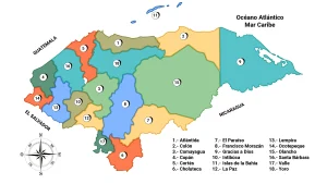
Leer en EspañolHonduras is geographically divided into 18 departments and 298 municipalities as well as 3,731 villages, and these into 27,969 hamlets.
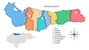
Department of Atlantida
It was officially created in 1902, from territories belonging to Colón, Cortés and Yoro. One of the 18 departments that make up Honduras.Municipality of San Francisco de la Paz
San Francisco de la Paz is a municipality in the department of Olancho in Honduras. The original name of the town was San Francisco Zapata, Bishop Francisco de Paula Campoy y Pérez having changed it to the one it currently bears, in 1829 the town was divided into two parts, the North part which was occupied by […]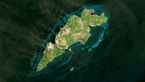
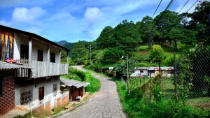
Municipality of Guanaja
The municipality of Guanaja is one of the islands that belongs to the Bay Islands Department. Christopher Columbus called it the Island of Pines.Located in the center of the Central American region, the Republic of Honduras is the second largest country in the area.
It physically borders three countries and two oceans, but paradoxically it has been one of the most isolated countries in the region due to its complex topography.
With an area of 112,492 square kilometers, Honduras shares borders: to the west with Guatemala (340 km) and El Salvador (356.5 km), to the north with the Caribbean Sea (650 km), to the east with Nicaragua (575 km), and to the south with the Pacific Ocean (65 km).
Political and Administrative Division of Honduras
Its political and administrative division consists of 18 departments, 298 municipalities, 3,731 villages, and 30,591 hamlets.
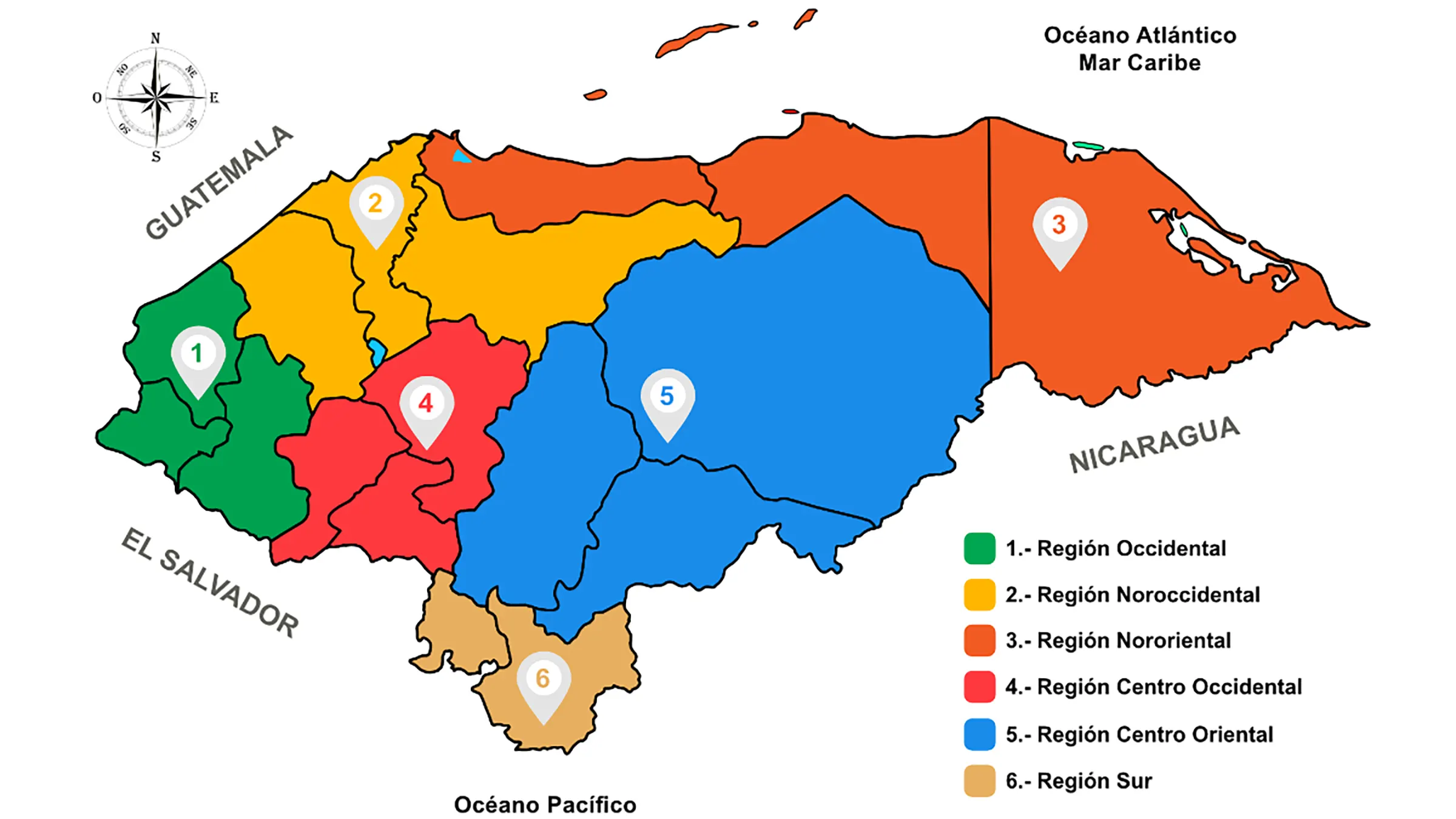
Geographical Regions of Honduras
Geographically, Honduras is divided into multiple regions, each showing unique characteristics based on their territorial extension, landforms, economic activities and production, as well as population centers.
Located in the center of the Central American region, the Republic of Honduras is the second largest country in the area.
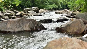
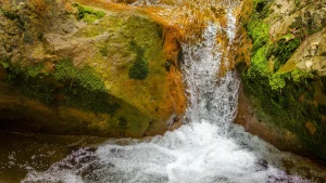
Hydrography of Honduras - Rivers, Lakes, and Lagoons
The hydrographic system of Honduras is formed by 19 river systems that originate within the national territory and flow into the Atlantic (Caribbean) and Pacific oceans.
Municipalities in Honduras by Department
Honduras is politically divided into 18 departments and 298 municipalities, as well as 3,731 villages, and within these, 27,969 hamlets.
Protected Areas and Parks of Honduras
Honduras has a rich natural wealth and diverse biodiversity, with mountains, valleys, and beaches found in both oceans.
Mountain Ranges of Honduras
Honduras is the most mountainous country in Central America, with two-thirds of its territory above three hundred meters in altitude. The highest mountain in the country is Celaque, reaching an elevation of 2,870 meters above sea level.
It is composed of 3 mountain ranges or groups: the Northern Mountain Range, the Central Mountain Range, and the Southern Mountain Range, as well as 6 Geographical Regions.
Among the longest rivers are the Coco or Segovia River, on the border with Nicaragua, and the Patuca River. The longest river on the Pacific slope is the Choluteca River. Lake Yojoa is the only lake in the country, and there are several lagoons along the Caribbean coast. The Coco and Patuca River deltas are home to the Caratasca Lagoon.
The forested area represents 48% of the territory, although a significant portion of the original forests have been logged or burned, and since late 2015, the country has been affected by the bark beetle plague, which lasted until early 2017 and devastated a quarter of the country's forests.
There are 92 protected areas covering a total area of 5.1 million hectares, with 61% being terrestrial and 39.1% being marine areas. The terrestrial area represents 27% of the country's land area.
Learn more about the Map of Honduras
The first general map of the Republic of Honduras at a scale of 1:500,000 was created by Dr. Jesús Aguilar Paz and approved by the Government through agreement number 689 on January 23, 1930.
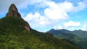
Mountains of Honduras
The Mountains of Honduras are grouped into 3 mountain ranges that are part of the Central American Mountain Range, covering 82% of the national territory.
Valleys of Honduras and their production
Honduras has 31 valleys that are agricultural production areas and serve as a significant support for the country's economy.
Seaports
- Puerto Cortés (Cortés)
- La Ceiba (Atlántida)
- Puerto Castilla (Trujillo, Colón)
- Roatán (Islas de La Bahía)
- Puerto Henecán (San Lorenzo, Valle)
- Tela (Atlántida)
- Puerto Lempira (Gracias a Dios)
Airports
- Toncontín International Airport: Tegucigalpa
- Ramón Villeda Morales International Airport: San Pedro Sula
- Golosón International Airport: La Ceiba
- Juan Manuel Gálvez International Airport: Roatán, Bay Islands.
- Palmerola Airport
Click here to see Customs in Honduras
Demography of Honduras
The population of Honduras is approximately 9,126,229 inhabitants, with a population growth rate of around 1.7%.
60.9% of the population lives below the poverty line, and 38.4% live in extreme poverty. The illiteracy rate is 11.1%.
- Population density: 81 inhabitants per km2;
- Life expectancy at birth: 72 years for males, 77 years for females;
- Population growth rate: 1.74%;
- Population under 18 years: 42.76%;
- Population over 65 years: 5%;
- HDI (Numeric value / World ranking): 0.625 / 130th out of 188 countries. In a comparative perspective, Honduras has the lowest HDI rating in Latin America;
- Birth rate: 20.88 per 1,000 inhabitants;
- Fertility rate: 2.33 children per woman.
Major Cities of Honduras
Tegucigalpa is the capital of Honduras and the seat of the Government of the Republic. Together with the former city of Comayagüela, it forms the Central District. It is located in the center of the country, and with approximately 1,508,906 inhabitants, it is the second most populous city in the Central American region after Guatemala City.
The city of Tegucigalpa is situated on a plateau at about 990 meters above sea level, surrounded by hills, with the prominent El Picacho hill (1,240 meters above sea level) to the north.
The second most populous city in Honduras is San Pedro Sula with 754,000 inhabitants; other important cities include: Choloma (231,669); El Progreso (188,366); La Ceiba (197,267); Danlí (195,916); Choluteca (152,519); Villanueva (149,977); Juticalpa (124,828); Comayagua (144,785); and Puerto Cortés (122,426).
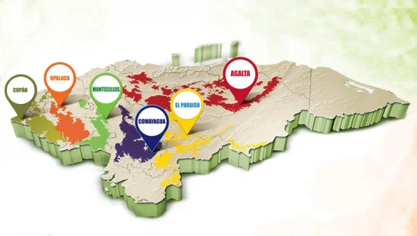
Geographical Regions of Coffee in Honduras
Honduras has mainly 6 geographical regions where coffee is cultivated and produced, making it one of the most sought-after products in the world. In the case of Honduras, it is internationally renowned for its high-quality coffee.
Copán, Opalaca, Montecillos, Comayagua, El Paraíso, and AgaltaClimate of Honduras
The mountainous interior is much cooler than the coast. Tegucigalpa, at an altitude of 990 m, has a temperate climate, with temperatures ranging from 25 to 14 °C in January to 30 and 18 °C in May. The coastal lands are much more humid and warmer, and the Gulf of Fonseca plain is sweltering.
December and January are the coolest months. Precipitation also varies depending on the regions.
In Tegucigalpa, the rainy season typically occurs from May to October, with a dry season from November to April that affects the entire country. In the months of September and October, it rains almost continuously, and floods are very common.
From November, the pace and frequency of rainfall drastically decrease throughout the country, except in the northern coast and Bay Islands, where the rains continue for several more weeks.


