City and Municipality of Choloma
Choloma is a municipality in the department of Cortés in Honduras.
It was an indigenous village that was distributed by Pedro de Alvarado in 1535-1536. In the census of 1887, it was registered as a village of San Pedro Sula.
On May 13, 1894, it obtained the status of municipality under the name El Paraíso, during the administration of Policarpo Bonilla. However, its name changed back to Choloma on September 26, 1933.
General Information about Choloma
- Date of Creation: May 13, 1894
- Territorial Area: 447.50 km2
- Elevation: 20 meters above sea level
- Patron Saint Fair: February 11, in honor of the Virgin of Lourdes
- Administrative Code (Geocode): 0502
- Villages: 41
- Hamlets: 245
Municipal Corporation
- Leopoldo Eugenio Crivelli Durant – Mayor
- Elena Espinal Aguilar – Vice-Mayor
- Miguel Ángel Alvarado Caravante – Council Member
- Leda Lizethe García Pagan – Council Member
- Doris Esperanza Ulloa – Council Member
- Marta Irene Cruz Cerrato – Council Member
- Alexander Mejía Leiva – Council Member
- Gustavo Antonio Mejía Escobar – Council Member
- Rafael Ángel Ugarte Florentino – Council Member
- Yessenia Ninette Montoya Pérez – Council Member
- Hugo Ricardo Rodríguez Milla – Council Member
- Jorge Fuad Jarufe Dox – Council Member
History
Read more about the history of Choloma
The original settlement of Tholoma was located near Conta and Cholula, indigenous villages on the banks of the Balaliama or Choloma River, first documented in the fifth letter of the conquistador Hernán Cortés regarding his conquest of the province of Honduras. It was also mentioned in the work of Berna Díaz on the same events in 1524-1525. In 1536, it was mentioned in the document about the Foundation of San Pedro de Puerto de Caballos (now San Pedro Sula), but it was not granted to any Spaniard in the Distribution of San Pedro. It was unoccupied after 1536 and does not appear in any colonial document after that effective year.
The town of Candelaria (Nuestra Señora de Candelaria de Masca), originally San Pedro Masca, was founded on the northern coast between Omoa and Manabique in pre-Hispanic times. The town was relocated to the Bijao River in 1683-84 for security reasons. The town was raided many times by pirates and Miskitos/Sambos on the coast. According to their request in 1714, it was moved again, as it was raided once more, to the south of the Bijao River, probably near El Boqueron in 1698. Candelaria/Masca was a town of Lenca-speaking people. Von Hagen (in «Los Torrupanes de Honduras») made an error in identifying the Candelaria near Choloma with the Candelaria Indian settlement of Xicaques (Torrupanes) near Guaymas. Today, this Candelaria still exists in the Department of Yoro, near Guaymas, north of Morazán, Yoro.
Of course, the last inhabitants of Nuestra Señora de Candelaria decided to become part of the new town of Choloma, founded in 1804, forming the Candelaria neighborhood of Choloma. In 1894, Choloma would be constituted as a municipality under the name El Paraíso. This name would last for 39 years until it was changed to its current name.
In the 19th century, the banana industry developed, and in the following century, sugar cane cultivation began. However, both plantations declined, and the inhabitants turned to livestock farming and the cultivation of citrus fruits and staple grains.
Main economic activities: banana cultivation, sugar cane, papaya, coffee, spices, vegetables, bananas, lemons, and staple grains; livestock farming of sheep, cattle, and horses; rabbit breeding and poultry farming.
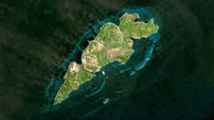
Location
The municipality is located in the Sula Valley in the northern part of the Cortés department, along the road that leads from San Pedro Sula to Puerto Cortés.
View on Google Maps
Territorial Extension
450.46 km2, of which 237.08 km2 are urban. The urban limit was expanded in 2008 to 85.77 km2.
Topography
It is located in the northwestern sector of the Sula Valley, Cortés Department. To the west of the municipality are the highest lands, corresponding to the Merendón Mountain Range and the Sierra de Omoa, with an average elevation of 500 meters above sea level and a maximum slope of up to 30% to the south. To the east of the municipality are low-lying lands with an average elevation of 40 meters above sea level and a maximum slope of 4%. The water table in this area ranges from 0.50 cms, providing relatively moist soils throughout the year.
Boundaries
- North: Municipality of Puerto Cortés and Omoa
- South: Municipality of San Pedro Sula and La Lima
- East: Municipality of Puerto Cortés
- West: Municipality of San Pedro Sula and Omoa
Hydrography
Area of Agua Merendón
Rivers
- Choloma River, Chamelecón River, Agua Caliente River
Lakes
- Ticamaya Lagoon, Jicaral Lagoon, Lama Lagoon, Telita Lagoon
Climate
The climate is of the tropical humid, equatorial type. The western part is cool and pleasant.
Orography
- La Gloria Hill (638 m), La Hicaca Hill, La Silla Hill, Will Hill
Flora and Fauna
The municipality is predominantly covered by forests of pine, oak, laurel, and cedar. As for fauna, it is becoming increasingly scarce due to rapid urban growth and deforestation.
Population
The total population is 231,668 inhabitants, of which 111,123 are male and 120,544 are female. 184,525 people live in urban areas, and 47,143 live in rural areas. Choloma ranks #2 in the department with 15% of the population and #3 in the country with 2.8% of the total population. 2.1% of the population belongs to an ethnic group. In the last 10 years, 3,015 people have left and are living in another country.
In this municipality, there are 134,361 people aged 18 and over, of which 96% have their identity card. The municipality has a literacy rate of 8.2% and a primary education coverage of 93%, with an average of 6.4 years of education. Female heads of households represent 29% of households, the masculinity index is 92 men per hundred women, and the elderly population (65+ years old) represents 3.3% of the population.
Cultural Heritage
- Ticamaya Lagoon
- National Railroad Station
- Archaeological Ruin «El Obelisco»
Economy
- 49% Manufacturing Industries
- 14% Wholesale and Retail Trade
- 9.2% Agriculture, Livestock, Forestry, and Fishing
- 6.4% Construction
- 4.1% Transportation and Storage
- 17% Other Activities
Agriculture
- Bananas, Sugar Cane, Papaya, Coffee, Spices, Vegetables, Bananas, Corn, Lemons, Staple Grains
Livestock Farming
- Rabbits, Sheep, Cattle, Chickens, Poultry, Horses, Ducks, and Geese
Commerce
Choloma has a wide variety of commercial options thanks to the diversity of industries in the municipality. Among its commerce, we can mention the various varieties of sweet and spicy colored chili peppers, as well as various aromatic herbs that are cultivated in Choloma using hydroponic systems.
Poverty Index
According to the Unsatisfied Basic Needs (NBI-2013), the poverty index is 45%, which is an increase of 1.7% from the national census of 2001. The extreme poverty index, according to the National Institute of Statistics (INE) 2005, Poverty Line method, is 33%. In the municipality, 15% of households own at least one vehicle.
Media
- Telephone Service, Mail, Telegraph, Transportation, Internet
Culture and Tradition
- The patron saint fair is celebrated on February 11 in honor of the Virgin of Lourdes.
- May 13 – Anniversary Celebration of Choloma
- December 8 – Tree Day «El Paraíso»
Tourism
- Ticamaya Lagoon
- National Railroad Station
- Archaeological Ruin «El Obelisco»
Creation Decree
In the population census of 1887, it was a village of San Pedro Sula. When Pedro de Alvarado visited this coastline in 1536, the town already existed.
Certification of the minutes of the installation of the first Municipality of Choloma, in the town of Choloma on May 3, 1894. Gathered at the residence of Mr. Jesús Urbina for the purpose of declaring the establishment of the Municipality of the town of Choloma, as provided by the resolution of the Political Governor of the Department on March 18 of the previous year, the elected members were sworn in, in accordance with Article 28 of the constitution. Once this was done, the Municipality of the Municipality, which will be named El Paraíso by the will of its inhabitants, is legally installed, signed for record. The following agreement changes its name.
Agreement No. 447. Tegucigalpa, September 26, 1933. The President of the Republic agrees:
To approve the minutes that literally say «Municipal Corporation, El Paraíso, Cortés Department, Republic of Honduras, C.A. The undersigned Municipal Secretary of this town certifies the point of the minutes that literally says: Minutes No. 26. Meeting room of the Municipal Corporation. El Paraíso (Choloma), September 15, 1933. The Municipal Corporation and the general public agree: Since the town of Choloma is of historical significance and there are other towns in the Republic with the name El Paraíso, it is recognized that the unique name of this town is Choloma.
Decree No. 110. The National Congress decrees: No. 110 Article 2, March 1954. It is elevated to the status of a city. F. Salomón Jiménez, President. Eliseo Pérez Cadalso, Secretary.