Municipality of San Manuel
San Manuel is a municipality of the department of Cortés in Honduras.
In the report of Governor Alonso de Contreras Guevara on the indigenous peoples of the province of Comayagua in 1582, the town called Tiuma had sixteen taxpayers. In the 1889 statistical yearbook, it is a town established as a municipality in 1859, during the administration of José Santos Guardiola.
General information about San Manuel
Origin of its name: in honor of its patron saint, San Manuel.
- Creation date: 1859
- Land area: 137.70 km2
- Altitude: 28 masl
- Patronal feast: from September 16 to 22, day of San Manuel.
- Administrative Code (Geocode): 0509
- Villages: 11
- Hamlets: 111
History
San Manuel is one of the oldest towns in the Department of Cortés. It used to be called Ulúa or Tehuma, and was part of one of the distributions made by Don Pedro de Alvarado in 1536. In the 1901 population census, it was listed as the head of the Curato belonging to the Tencoa party. Its head office was founded in a place called Campín (today a village), and it is not known why that place was abandoned and moved to its current location.
It was given the status of Municipality in 1859 when the Department of Cortés was created on July 4, 1893. In 1895 its name was changed to San Manuel.
With a population of 2,800 among Spaniards, mestizos, and indigenous people, the town of Tehuma, which in the Lenca language means «Waters of the Divine Magueyes», was founded 46 years before San Pedro Sula.
However, it was not until 1859 that Presbyter Lin. D. Antonio Vallejo in his first statistical yearbook of 1889 granted it the title of Municipality, with General Santos Guardiola as President of the Republic. The first municipal corporation, according to Vallejo, was made up of gentlemen Lázaro Crúz and Santiago Pineda as mayor and vice-mayor respectively; gentlemen Concepción Caballero and Hilario Montoya as councilors one, two and Don Ramón Leiva as municipal trustee.
Since its foundation, Tehuma continued to belong to the Tencoa party like most of the towns in the departments. It was not until July 4, 1893, when General Domingo Vásquez created the department of Cortés, that it definitively became part of it.
First Settlers
It is believed that the current foundation of the municipalities in the area is due to the emigration of their first inhabitants as a result of the constant floods from the Ulua River.
Formerly known as Olúa or Theuma, it is one of the oldest towns. It was part of the distributions made by don Pedro de Alvarado in 1536. During the pre-Columbian era, it housed indigenous communities whose development has been proven by findings and research discovered in major centers such as Travesía, Coowle, Palenque, and Playa de los Muertos.
In 1582, the town called Tiuma had sixteen tributaries. In the population count of 1791, it was listed as the head of a curate, belonging to the party of Tencoa. Its head was founded in a place called Campin (now a village). It is possible that the area comprising the municipality of San Manuel was not populated, like other municipalities, as the floods of the Ulua River did not allow the stability of the settlers, forcing them to move from one place to another. It was designated as a municipality in 1859. When the department of Cortés was created on July 4, 1893, it became part of it. In 1895, its name was changed to San Manuel.
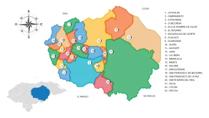
Location
This municipality is located between the Chamelecón and Ulua rivers.
View on Google Maps.
Limits
- North: municipalities of San Pedro Sula and La Lima;
- South: municipality of Pimienta;
- East: municipality of El Progreso (Yoro);
- West: municipality of Villanueva.
Topography
The municipality is dominated by a fairly regular topography, with the existence of a mountain reserve area between the village of La Libertad and El Porvenir, which is used for perennial crops such as sugarcane and bananas. 80% of the terrain is flat, while the remaining 20% is hilly or mountainous, suitable for forestry.
Hydrography
- Ulúa River and Chamelecón River
- Creeks: Chasnigua Creek: It provides a water source and runs through the communities of El Marañón, La Coroza, Santa Eduviges, El Colón, Santa Teresa, Brisas del Calán, San José 5, Grupo Fe y Esperanza, and El Milagro in the neighboring municipality of Villanueva. El Plan Creek, which originates in the mountains and hills of the West.
- Lakes: Santa Ana Lagoon
Climate
In the municipality, a warm climate prevails for most of the year, with the rainiest months being October and August.
Topography
Hills: La Lima, El Caliche, El Encanto, La Tabla, and La Sierra.
Flora and Fauna
The municipality has an abundance of ornamental, fruit-bearing, and medicinal plants. The hills are dominated by pine, oak, guamo, ceiba, laurel, cedar, and other trees.
Wildlife is scarce in the municipality due to deforestation, hunting, and population growth. Currently, there are animals such as squirrels, rabbits, opossums, agoutis, some bird species, and snakes.
Population
The total population is 53,082 inhabitants, of which 25,430 are males and 27,651 are females. 29,522 live in urban areas, and 23,560 live in rural areas. The municipality ranks #7 in the department, accounting for 3.4% of the population, and #24 in the country, accounting for 0.6% of the total population. 1.4% of the population belongs to an ethnic group.
In the last 10 years, 957 people have emigrated and live in another country. In this municipality, there are 30,573 people aged 18 and over, of which 94% have an identification card. The municipality has a literacy rate of 9.1% and a primary education coverage of 95%, with an average of 6.4 years of schooling. Female heads of households represent 29% of households, the sex ratio is 92 males per 100 females, and the elderly population (65+ years) represents 4.1% of the population.
Economy
- Agriculture: Sugarcane, Bananas, Citrus fruits, Basic grains, Cocoa, Tobacco, Vegetables.
- Livestock: Cattle, Pigs, Ducks, Turkeys.
- Industry: The CASMUL Cooperative has been one of the strong companies in our municipality for many years. Their specialty is banana cultivation, which is exported to various parts of the world, providing employment to a significant portion of the communities belonging to San Manuel.
Tourism
La Tabla Resort, open from Monday to Sunday, entrance fee: 100 lempiras for adults and 50 lempiras for minors.
Creation Decree
(Formerly known as Olúa or Theuma), it is one of the oldest towns. Its origin is unknown, but it was already listed as the head of a curate belonging to the party of Tencoa in the population count of 1791. It was granted the status of a municipality in 1859.
When the Department of Cortés was created on July 4, 1893, the Municipality of San Pedro Sula requested the segregation of the village of La Lima from the Municipality of San Manuel and its annexation to San Pedro Sula, Department of Cortés.
On November 13, 1948, the Local District of San Manuel was created, and municipal autonomy was restored in 1957.