Municipality of Santa Bárbara
Santa Barbara is a municipality in the department of Santa Barbara in Honduras.
First foundation
The town began to emerge with the establishment of haciendas that were granted on May 5th and 6th, 1633, as follows: Catakila for Francisco de Silva, a resident of Tencoa; Felipe de Orellana, a resident of Gracias; and Cristóbal Fernández de Contreras, a resident of the city of Gracias. Cececapa was granted to Andrés de Rosales, a resident of the city of Gracias, and Concepción de Iztacapa to Antonio de Mansilla on May 5th. These areas now correspond to the city center, El Llano del Conejo neighborhood, Barrio Galeras, and Gualjoco. The owners were Spaniards who had their homes in the Ulúa River valley. The documents also mention that there was a bridge made of vines called Calicanto Las Rocas Bridge, currently known as the Cececapa River Bridge, which allowed transit between Cececapa and Cataquiles.
The construction of rustic housing for the ladinos in 1633, which over time became known as «Paraje de Cataquiles,» is considered the founding of the city. In 1744, some military personnel from Tencoa opposed the relocation of the district capital to the mentioned place. This information is based on a note sent to the Captaincy General of Guatemala.
Second foundation
By 1761, the town of Santa Barbara was firmly established and had a church administered by the parish priest Manuel de Pagán. The most important families at the time were: Captain Matheo de Rodríguez, Gregoria Antonia de Rodríguez, Lieutenant Calletano de Ullóa, Captain Mathias de Bueso, Feliciano Madrid, Francisco Enamorado, and Pedro de Bayde. In the 1791 population census, Santa Barbara was one of the towns that formed the Tencoa curate.
The town experienced some economic growth at the end of the 18th century. In 1798, the Intendant Ramón Anguiano proposed that Santa Barbara de Cataquiles become the capital of Honduras due to disagreements between Comayagua and Tegucigalpa. The proposal highlighted the town’s healthy environment, fertile land, and the potential to make the Ulúa River navigable to the coast, creating river ports for trade with the north. The report was known in Spain fifteen years later but was not approved.
Santa Barbara began as the district capital of Tencoa between 1786 and 1787, but it faced opposition from neighboring towns. Eventually, on July 18th, 1797, its status was confirmed, and on June 28th, 1825, the town was approved as the municipal center of Santa Barbara in Central America.
These facts are considered appropriate to commemorate the creation of the municipality based on documentary evidence. The population increased due to the emigration of inhabitants from Tencoa and nearby areas affected by the cholera epidemic in 1804.
On April 25th, 1815, the town of Tencoa was completely destroyed by the flooding of the Ulúa River, forcing the residents to flee to Santa Barbara and settle in a place called Barrio El Guayabal, presumably near the current Barrio La Curva, where a small hacienda with that name existed in the mid-19th century.
On September 22nd, 1848, Santa Barbara was granted the title of city. By 1866, it was the largest and most important town in western Honduras, with a population of 3,524 people.
In 1921, the village of Macholoa, which belonged to the municipality of San Nicolás, was annexed. On November 12th, 1940, the Santa Barbara Departmental District was created, consisting of the Santa Barbara Municipality. Municipal autonomy was restored in 1957.
Location
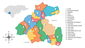
The municipality borders the municipalities of Gualala, Ilama, and San José de las Colinas to the north, Ceguaca, Santa Rita, and Concepción del Sur to the south, Santa Cruz de Yojoa and San Pedro de Zacapa to the east, and Arada, San Vicente Centenario, San Nicolás, and Nuevo Celilac to the west.
The city of Santa Barbara is located in the department of the same name, an area with significant natural resources drained by the Ulúa and Chamelecón rivers, with important gold and silver deposits. Its most representative industry is the junco industry.
Villages
- Agua Blanquita
- Cerro Grande
- Coquillal
- El Salitre
- El Cielito
- El Zapote
- El Diez y Ocho o Miraflores
- El Moguete
- El Portillo del Jarro
- Guayabito
- Gualjoco
- Inguaya
- La Estancia
- La Zona
- La Unión el Dorado
- La Ceibita
- La Cuesta
- La Unión del Dorado
- Las Crucitas
- Las Palmas
- Las Lagunas
- Las Quebradas
- Los Laureles
- Los Anises
- Los Bancos
- Macholoa
- Orconcitos
- Plancitos de Suyapa
- Río Seco
- San Jerónimo el Pinal
- San Gaspar de Tablones
- San Luis Planes
- Santa Rosalía
- Santa Rita de Oriente
- Santa Barbara
The Bográn Castle, popularly known as «la Casa Brográn,» is a magnificent building that combines palace and fortress architectural styles. It was constructed with European architecture and served as the residence of Mr. Saturnino Bográn Bonilla and his wife Gertrudis Barahona Leiva. The Bográn family is descended from General Romaín Bougrand, of French origin, whose descendants had a prominent role in the political life of the country.
The Bográn Castle was built in the 19th century and is currently in a state of complete deterioration due to neglect. The fortified building is located on a hill between the city of Santa Barbara, La Ceibita, and El Cerro Grande. From this position, the surrounding area and the property’s perimeter can be perfectly seen.
The Bográn house is constructed with stone, clay bricks, wooden beams for the roof, and tile coverings. The walls are thick and reinforced with up to three layers of bricks to withstand artillery fire. The facade features a tower with three circular entrances, facing a staircase built into the slope of the hilltop. It has a main hall, bedrooms, a kitchen, side doors and windows, stables, and a cellar.
Legend has it that there is a tunnel from this mansion that leads to the center of the city of Santa Barbara. The mansion can be accessed via an unpaved road, approximately four kilometers north of the city of Santa Barbara, near Cerro Guatemalita and adjacent to the Santa Barbara Mountain National Park.
Education
Since 2004, the city of Santa Barbara has been home to a branch of the Technological University of Honduras (UTH) and another branch of the Francisco Morazán National Pedagogical University (UPNFM). It also has the Distance Education System (SUED) of the National Autonomous University of Honduras (UNAH) and an associated center of the Nuevo Milenio Evangelical Christian University (UCENM).
Health
The Santa Barbara Hospital is located in the Northern Neighborhood of the city and has been serving a significant number of residents from both the Santa Barbara department and the Lempira department since 1957.
Sports
Santa Barbara has been represented in the National Football League of Honduras by the Real Juventud club, which plays its home games at the Argelio Sabillón Stadium. Before that, the Real Patepluma also played in the city of Santa Barbara, previously known as Real Comayagua and originally as Real Maya.
Santa Barbara has had athletes who have represented the town throughout their sports careers, especially in football. Notable figures include Ángel Ramón Paz (Mon Paz) and Francis Reyes, Josue Reyes, Henry Enamorado, Mario Reyes, Marvin Mazariegos, Eric Portillo, and Randy Diamond. Referees Argelio Sabillón and Benigno Pineda both had FIFA badges, and as a football coach, Mauro German Reyes stood out. He currently works in the Honduran National League and Ascenso League.
Gastronomy
Traditional dishes in the region include chilate, ticuco, corn atol, chicken and pork tamales, yuca with chicharrón, torrejas, and horchata.
Economic activities
This city is known for coffee cultivation and craftsmanship, which are the main economic activities in the area.