Municipality of Santa Cruz de Yojoa
Santa Cruz de Yojoa is a municipality in the department of Cortés in Honduras.
General Francisco Ferrera founded a cattle ranch in the area where the town is now located in 1832. The neighborhood quickly expanded with the arrival of some families from Santa Bárbara. In 1864, it was granted the status of a municipality during the provisional government of José María Medina.
Origin of its name: in honor of the Holy Cross.
General Information about Santa Cruz de Yojoa
- Date of creation: 1867
- Territorial area: 722.40 km2
- Elevation: 460 meters above sea level
- Patron saint festival: May 3rd, the day of the Holy Cross
- Administrative Code (Geocode): 0510
- Villages: 48
- Hamlets: 309
History
What is now the Municipality of Santa Cruz de Yojoa used to be the Municipality of Yojoa. According to Father Adán Call Canyells, «Yojoa» is a word in the Humuya language that means «water that is at a high place,» referring to our Lake Yojoa.
According to Dr. Adán Cuevas, who was the director of the Honduran Institute of History and Anthropology at the time, Yojoa had been founded by the Spanish in 1570. The old colonial church stands as a witness to that foundation. Its jurisdiction extended from Morazán to Santa Bárbara.
In 1808, Yojoa was devastated by the yellow fever and cholera epidemics, which destroyed the majority of the population. It is said that Manuel Barahona donated land to be used as a cemetery. When it was full, they would dig a pit in each house to bury all the family members. When the last person died, the house was sealed. That is how Yojoa was lost, and another part of the population migrated to the neighboring towns of San Francisco and Santa Cruz de Yojoa.
At that time, Santa Cruz was a small settlement when the first settlers from Comayagua arrived to work on a cattle ranch. The workers were hired by General Francisco Herrera, who arrived in Santa Cruz de Yojoa on the day of the Holy Cross, May 3rd, 1832, giving the town its name in honor of that day.
In 1844, the population of Santa Cruz had grown, and they requested permission from General Herrera to build a small chapel.
In 1864, Santa Cruz de Yojoa was elevated to the status of a municipal seat, with Norberto Barahona being its first mayor. In 1867, it was elevated to a district, including the municipalities of Potrerillos, San Antonio de Cortés, San Francisco de Yojoa, and Santa Cruz de Yojoa. In 1881, Yojoa became simply an aldea (hamlet) of Santa Cruz.
It is known by tradition that General Francisco Ferrera founded a cattle ranch in the same place where this town is located around 1832. The workers hired for this ranch settled in this area and acquired land. In 1864, Santa Cruz was just a precinct belonging to the town of Yojoa. In the same year, it was granted the title of Municipality, requesting it from the Political Government of Santa Bárbara to which it belonged.
In 1867, it was elevated to the status of a district seat, and in 1881, the Municipality of Yojoa was abolished, and it became an aldea of the Municipality of Santa Cruz. Lake Yojoa, located in the southwestern part of the municipality, covers a large area, from Las Ventanas, bordering the Department of Santa Bárbara to the north, to La María creek, bordering the Department of Comayagua to the south.
Location
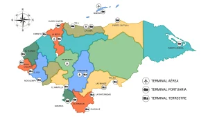
The municipality of Santa Cruz de Yojoa is located in the southernmost part of the department. The Yojoa Lake is situated in its southwestern extreme, and the Francisco Morazán Dam is found in the southeast.
View on Google Maps.
Boundaries
- North: municipalities of Potrerillos and Santa Rita (Yoro)
- South: municipalities of Meámbar and Taulabé (both in Comayagua)
- East: municipalities of La Libertad (Comayagua) and Victoria (Yoro)
- West: municipalities of San Francisco de Yojoa, San Antonio de Cortés, and Santa Bárbara (Santa Bárbara)
Hydrography
Rivers
The Santa Cruz de Yojoa valley is drained by the tributaries of the Blanco River, Yuré River, El Zapote River, Gualale River, and El Potrero River.
Due to its location and topographical features, Santa Cruz de Yojoa has a significant number of water sources, including rivers, numerous streams, and two large water reservoirs: the Francisco Morazán Hydroelectric Dam, located to the east of the municipality, with a surface area of 94 km², and Lake Yojoa, located to the southwest of the municipality, with a surface area of 88 km².
Santa Cruz de Yojoa has important water reserves in the country, such as Lake Yojoa, which provides water to the Cañaveral hydroelectric plant, the protected area of Cerro Azul Meámbar, and the Francisco Morazán Hydroelectric Dam (El Cajón reservoir), which is the largest hydroelectric project in the country, supplying 75% of the hydropower energy. The municipality of Santa Cruz de Yojoa contributes to this through the Yuré River.
- Blanco River, El Potrero River, Comayagua River, Gualala River, Yojoa River, El Zapote River, Yure River
Streams
- Las Cañas Stream, La Puerta Stream, Torres Stream
Lake Yojoa
Lake Yojoa is the only lake in Honduras and is located between the departments of Comayagua, Cortés, and Santa Bárbara at an altitude of 650 meters above sea level. It has a perimeter of 50 kilometers and an estimated area of 90 km². The entire Yojoa-Lindo River basin covers an area of 330 km².
The lake likely originated from faults as a result of the Laramidian orogenic revolution, forming a graben or trench where the lake is located, with depths of over 210 meters.
It was declared a multiple-use reserve zone in 1971 and covers an area of 346.28 square kilometers. Due to its special characteristics, the area deserves special attention in terms of landscape, historical, archaeological-geological, botanical, and zoological aspects.
With a surface area of 89 square kilometers, this basin constitutes the largest freshwater reserve in the country and is considered one of the eight largest life reserves in the national geography.
Legally, Lake Yojoa falls within the category of a multiple-use reserve, including tropical forests, fauna, and the watershed, with the purpose of maintaining and protecting land use conditions.
Orography
- Danda Hill, El Duende Hill, El Volcan Hill, Leones Hill, Picacho Hill, Pelon Hill, Redondo Hill
Climate
The municipality of Santa Cruz de Yojoa has a very rainy and windward (semi-seasonal) climate, with June and September being the rainiest months and March and April being the driest months. The average annual temperature ranges from 20°C to 25°C.
Precipitation
According to a study conducted by Mr. Edgardo Zúñiga Andrade, the annual precipitation in the municipality ranges from 2000 mm to 2600 mm. In the northern area of the lake, there is an average humidity of 82%.
Flora and Fauna
Flora
Timber species: Granadillo, Hormigo, Cortes, Ceiba Sauce, Zapote, Tuna, San Juan, Mahogany, Cedar, Walnut, Guanacaste, Cortes, Laurel, Santa María.
The ecological systems of the municipality of Santa Cruz de Yojoa are structured as follows:
- Dry forests: located in the lower part of the municipality.
- Semi-humid tropical forests: located at medium altitudes, near Lake Yojoa.
- Cloud forests: have a limited influence in the southern part of the municipality, bordering the protected area of Cerro Azul Meámbar.
- Wetland areas: along the shore of Lake Yojoa and in the northern part.
- Pine forests: mostly located in the northeastern region and in the influence zone of Lake Yojoa.
Fauna
The ecological reserves of the Cerro Azul Meámbar National Park and Lake Yojoa are home to a large number of animal species, including:
- Birds: Muscovy Duck, Black Hawk, Tree Heron, Snowy Egret, Red-lored Parrot, Keel-billed Toucan, and Kingfisher.
- Reptiles: crocodiles, turtles, geckos, and bass (the latter introduced in the 1950s by researchers from the Tela Rail Road Co.).
- Aquatic: common guapote, armadillo, catfish, carp, machaca, and tilapia (introduced in 1964 within the Lake Yojoa basin).
Many species of flora and fauna in these ecosystems are endangered, so hunting of any kind and the use of prohibited timber species are strictly prohibited.
The ecological reserves of the Cerro Azul Meámbar National Park and Lake Yojoa are home to a diverse range of animal species, including various bird species such as the Muscovy Duck and the coffee tree duck. Crocodiles and aquatic species are also abundant.
Population
It has a total population of 82,760 inhabitants, of which 40,566 are men and 42,193 are women. 27,044 people live in the urban area, and 55,715 people live in the rural area. In terms of population, it ranks #5 in the department, representing 5.3% of the total population, and #18 in the country, representing 1.0% of the total population. 0.9% of the population belongs to an ethnic group.
In the last 10 years, 1,706 people have emigrated and now live in another country. In this municipality, there are 45,870 people aged 18 and older, of which 91% have their identification card. The municipality has a literacy rate of 13% and primary school coverage of 93%, with an average of 6.1 years of schooling. Women heads of households represent 28% of the households. The sex ratio is 96 men per hundred women, and the elderly population (65+ years) represents 4.8% of the total population.
Economy
- 45% Agriculture, Livestock, Forestry, and Fishing
- 15% Manufacturing Industries
- 12% Wholesale and Retail Trade, Vehicle Repair
- 7.3% Construction
- 3.8% Transportation and Storage
- 17% Other Activities
Agriculture
Due to the economic, geographic, and physical conditions of the municipality of Santa Cruz de Yojoa, various activities are developed, which can be grouped as follows:
Annual Crops: The basic crops include maize, beans, cassava, onions, tomatoes, cabbage, sweet peppers, watermelon, and tobacco. Vegetable cultivation is not widespread in the municipality for commercial purposes, as there is a strong tendency towards subsistence family gardens. These crops are threatened by drought and landslides, as these agricultural practices are mostly carried out in vulnerable central areas prone to landslides.
These crops are utilized due to the fertile land conditions, resulting in an annual vegetable harvest of 1,921 farms and an area of 3,787.6 per year.
Permanent Crops: The permanent crops include coffee, cocoa, sugarcane, oranges, grapefruits, lemons, coconuts, avocados, mangoes, annatto, black pepper, bananas, plantains, and pineapples.
Most of these crops are for domestic consumption as well as for export. These fruits are commercialized, providing a good economic income to the families engaged in this sector during the harvest seasons.
- Sugarcane, Banana, Coffee, Cocoa, Citrus fruits, Apples, Tilapia, Soy, Tobacco, Basic grains.
Livestock
Cattle: Cattle farming is carried out on a large scale, with 623 farms and 25,000 heads of cattle. Most of the operations are focused on meat production, which requires larger grazing areas.
Horses: There are no specialized horse production farms. Horse breeding is maintained collaterally to support the management of the cattle herd for herding, grazing, and sometimes for animal traction to support plowing activities.
Pigs: There are 806 farms where pigs are raised, and the presence of 125 pigsties indicates that their management is traditionally established around family orchards. There are also industrial pig farms in the municipality, such as PROCARNE.
Poultry Production: There are 1,574 farms involved in poultry production, which constitutes a significant source of employment, particularly in groups like CADECA, ALCON GRAYSA, and CONAGRI.
- Poultry, Cattle, Goats, Rabbits, Pigs
Commerce
The municipality of Santa Cruz de Yojoa has many commercial potentials in agriculture, livestock, fishing, as well as tourism and human resources. It is an area with incentives and financing options for the development of micro, medium, and large enterprises.
In the main commercial areas of the municipality, such as Santa Cruz de Yojoa and Peña Blanca, there are predominantly small and medium-sized businesses. These include carpentry workshops, joinery shops, welding and mechanical workshops, hardware stores, grocery stores, appliance stores, and agricultural product stores, among others.
It is worth mentioning that the economy and employment in the municipality have been strengthened by the operation of maquilas (manufacturing plants) in the Sula Valley. Many young people, especially women, commute to work in these industrial zones.
One of the sources of income in the Lake Yojoa area is fishing. Fishermen sell their catch in stalls along the lake shore, which becomes a tourist attraction for visitors to the North Coast, especially during the summer season.
In the agricultural sector, there are crops that require more financial support. Given the agricultural vocation of the area, agriculture tends to be the most developed sector. There are several cooperatives or producer associations involved in various crops, including pineapple, coffee, plantain, and banana.
Industry
There are commercially valuable woods such as mahogany, cedar, granadillo, walnut, guanacaste, cortes, laurel, san juan, and santa maría. All these species are used nationally for furniture production and house construction.
Tourism
Lake Yojoa
Lake Yojoa is the only inland lake in Honduras, bordering the departments of Cortés, Comayagua, and Santa Bárbara. Enjoying fried fish with slices of green plantains while the cool lake breeze caresses you is one of the pleasures for visitors.
In addition to dining, visitors can take a boat ride and appreciate the beauty of this national treasure up close. Nearby is the Francisco Morazán Hydroelectric Power Plant, also known as El Cajón, the largest in Central America.
There are archaeological remains at the El Naranjo site.
Joya Grande Zoo
Located about 15 minutes from the community of Santa Cruz, this zoo features a variety of exotic animals. African lions, white-faced monkeys, spider monkeys, zebras, beautiful ostriches, peacocks, hippos, coatis, buffalos, sheep, and ponies, among others, are admired by visitors in a spacious natural setting with rest areas that invite you to spend several hours in the place.
This eco-park offers other activities for those who not only want to admire the animals. Adventure lovers can engage in extreme sports. The park features three canopy routes with seven, eleven, and 14 cables.
There are also the mysterious Joya Grande caves. There is a route for riding ATVs, and horseback riding is available for scenic tours that disconnect you from the noise and tension of the cities, enveloping you in a completely natural environment. In addition, there are swimming pools for those who can’t resist a swim and sunbathing, slides for children, and soccer fields.
Cerro Azul Meámbar National Park
Cerro Azul Meámbar National Park is located between the Francisco Morazán Hydroelectric Power Plant (El Cajón) and Lake Yojoa, spanning the departments of Comayagua and Cortés. It encompasses parts of the municipalities of Siguatepeque, Meámbar, and Taulabé in the department of Comayagua, and the municipality of Santa Cruz de Yojoa in the department of Cortés. Access to the park is very easy. The park covers an area of 304 km², with a core zone of 7.8 km².
The park gets its name from the impressive mountain that stands out, contrasting with its dark blue color. Locals have been calling it «Cerro Azul» for a long time, and the term «Meámbar» indicates that the highest summit is located in that municipality.
Cerro Azul Meámbar National Park is a freshwater reserve and is home to a variety of plant and animal species, particularly notable for its birdlife, including the quetzal, the green toucan, and the scarlet macaw.