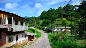
Municipality of Vado Ancho
It is a municipality in the Department of El Paraíso, in the Republic of Honduras.
The exact date of its foundation is unknown, but by 1887, it had already been established as a municipality, as stated by Antonio Vallejo in the statistical yearbook of 1889, under the jurisdiction of Texiguat, until the creation of the department of El Paraíso.
General Information about Vado Ancho
Origin of its name: Its name derives from the geographical feature formed by the Texiguat River that passes through the departmental seat.
- Territorial area: 84.63 km2
- Population: 4,268 inhabitants (2012)
- Date of creation: 1887
- Patron saint fair: February 2, Feast of the Candlemas.
- Villages and hamlets: 4 villages and 16 hamlets.
- Altitude: 250 meters above sea level.
- Climate: Transitional with low rainfall.
Main Economic Activity
Cultivation of basic grains, sugarcane, forage sorghum, and coffee; breeding of cattle, horses, pigs, and poultry farming.
Infrastructure
- Health: 1 CESAR.
- Education: 16 primary schools, 1 pre-basic education center, 4 basic education centers, 1 kindergarten, and 1 secondary school.
- Transportation: Buses that travel along the southern and eastern highways.
Location
Located at the foot of Mount «El Danto.»
Limits
- North: municipalities of San Lucas and San Antonio de Flores;
- South: municipality of Liure;
- East: municipality of Morolica (Choluteca);
- West: municipality of Texiguat.
Hydrography: Rivers Chiquito and Texiguat.