Tegucigalpa – Official Capital of Honduras
Tegucigalpa is the capital of Honduras and the seat of the government of the Republic, along with Comayagüela. Both cities form the Central District Municipality.
It was founded on September 29, 1578 and became the capital of the country on October 30, 1880, under the government of President Dr. Marco Aurelio Soto. Tegucigalpa is the largest and most populous city in Honduras, as well as the political and administrative center of the nation.
Tegucigalpa is home to 23 embassies and 16 foreign consulates, as well as several state entities such as ENEE and Hondutel, the national energy and telecommunications companies, respectively. The city is also home to the country’s most important university, the National Autonomous University of Honduras.
See also Real Minas de la Villa de San Miguel de Heredia de Tegucigalpa

Municipal Corporation
- NASRY JUAN ASFURA ZABLAH – Alcalde Municipal
- EVA DEL CARMEN LOPEZ PERAZA – Vice-Alcalde Municipal
- JUAN CARLOS GARCIA MEDINA – Regidor (a)
- SILVIA CONSUELO MONTALVAN MATUTE – Regidor (a)
- JOSE JAVIER VELASQUEZ CRUZ – Regidor (a)
- NILVIA ETHEL CASTILLO CRUZ – Regidor (a)
- CARLOS ROBERTO AMADOR – Regidor (a)
- MARTHA ALICIA GARCIA CASCO – Regidor (a)
- MARTIN STUAR FONSECA ZUNIGA – Regidor (a)
- JORGE ALEJANDRO ALDANA BARDALES – Regidor (a)
- OSMAN DANILO AGUILAR PONCE – Regidor (a)
- JOSELYN MARISOL ARDON MUNGUIA – Regidor (a)
History
Foundation, Colony, and Independence
In its early days, Tegucigalpa was settled by a group of Spaniards who were searching for silver veins in the area around 1560. With the growth of the mining town, it became known as Real Villa de San Miguel de Tegucigalpa de Heredia on September 29, 1578, built on top of an existing indigenous settlement. During that time, the Tegucigalpa area was a center of mining activity, particularly for silver and gold extraction.
The first mayor of Tegucigalpa, Juan de la Cueva, could never have imagined that this charming and picturesque city would later become the most important area in Honduras, hosting the main government offices and private sector.
It was founded in 1578 as a mining center, and de la Cueva was appointed mayor in 1579. The population was called «Real de Minas de Tegucigalpa» and obtained the title of Villa de San Miguel de Heredia.
Throughout the colonial period, the villa remained a mining town, extracting minerals from Cerro El Picacho and the mountainous area of San Juancito. With the country’s independence, the capital of the Republic of Honduras alternated between Tegucigalpa and Comayagua several times until it was definitively established in Tegucigalpa in 1880.
In 1817, at the initiative of Mayor Narciso Mallol, the construction of a stone bridge with seven arches began over the Choluteca River. The work, completed four years later, connected Tegucigalpa with the neighboring city of Comayagüela on the opposite bank of the river. Today, it is popularly known as the Puente Mallol.
In 1821, Tegucigalpa was elevated to the rank of city. In 1824, the first congress of the Republic of Honduras decreed that Tegucigalpa and Comayagua, the two main cities in the country, would alternate as the capital of the state. However, on October 30, 1880, the government headquarters was permanently moved to Tegucigalpa as the capital of the state. It was decreed that civil authorities would reside there, except for the Supreme Court of Justice, which would remain in Comayagua. The offices dependent on the Supreme Government were immediately relocated.
In 1847, the first university in the country was founded under the name of La Sociedad del Genio Emprendedor y del Buen Gusto, with the priest José Trinidad Reyes as its first rector. It is worth noting that the National Museum has a remarkable collection of pre-Columbian objects.
Since 1898, it was established that Tegucigalpa and Comayagüela, the two neighboring cities on both sides of the Choluteca River, would form the capital, but maintaining separate names and two municipal governments. At that time, they had a population of around 40,000, and the Central District, including surrounding areas, had over 50,000 inhabitants.
Tegucigalpa has been the birthplace of illustrious Honduran patriots and statesmen, such as Dionisio de Herrera, Francisco Morazán, José Trinidad Cabañas, José Trinidad Reyes, General José Santos Guardiola, Doctor Marco Aurelio Soto, among others.
Contemporary Era
Tegucigalpa has grown in the last 50 years, but it has become a disorganized city due to the lack of planning. Migration from rural areas to the city has increased the population, especially in the surrounding areas located on the slopes of numerous hills, many of which lack urbanization.
The city of Tegucigalpa is constantly expanding. Currently, residential development is focused on the southern part of the city, from Toncontín Airport to the area near Los Laureles Dam. As bedroom communities, we have Santa Lucía and Valle de Ángeles in the northeast zone.
On October 30, 1998, the city suffered significant damage from the passage of Hurricane Mitch, which destroyed a part of Comayagüela and the areas bordering the Grande or Choluteca River. The hurricane remained over Honduran territory for five days, causing the soil to be unable to absorb so much rain. Coupled with deforestation, this led to severe flooding throughout the country, mainly in Tegucigalpa.
The rising waters of the Grande or Choluteca River caused it to exceed the height of the Juan Ramón Molina Bridge, which was swept away by the current and quickly replaced with a Bailey bridge.
The rains also triggered landslides in the El Berrinche hill area. These landslides swept away most of the Soto neighborhood, and the debris fell into the river basin, creating a dam at the height of that neighborhood. This dam caused the flooding in the lower parts of Comayagüela, destroying the old establishments located near Calle Real. In other areas, the current caused hills, mountains, and slopes to collapse, taking entire neighborhoods, buildings, parks, cars, etc., with them. The areas most affected were those near rivers.
Currently, Tegucigalpa has been undergoing significant growth in several important aspects.
Historic Center
The historic center of Tegucigalpa strongly attracts attention for its unique configuration: with its narrow streets, many of its stone buildings, and surrounded by hills with the warm spirit of its residents.
Among some early 20th-century buildings, we have:
- Medina Planas Building.
- La Leona Park.
- Fountain and staircase towards the La Leona neighborhood.
- Manuel Bonilla National Theater.
- Legislative Palace of the National Congress.
- Central Bank of Honduras.
- Bancatlán Hall.
The historic center of Tegucigalpa preserves some interesting examples of colonial architecture from the 18th and 19th centuries. The most important religious buildings are:
- San Miguel Cathedral (Tegucigalpa), located in the city center.
- The Sanctuary of the Virgin of Suyapa in the Basilica of Suyapa on the outskirts, towards the east.
Toponymy
The exact meaning of the name Tegucigalpa has not been determined yet. The most widely spread version is that it comes from the Nahuatl word «Taguz-galpa,» which means «silver hills,» but it is difficult to support as the natives were unaware of mineral deposits in the area.
On the other hand, it is said that the word Tegucigalpa is derived from another language meaning «Painted Stones,» which can be found in the book «Historia mínima de Tegucigalpa» by Leticia Oyuela.
There are two important facts in this etymological problem: the term «Togogalpa» refers to «tototi» (a green parakeet in Nahuatl) and to Toncontín, a town near Tegucigalpa (the «toncontín» is a Mexican dance of Nahuatl origin used in 17th-century Baroque theater).
In Mexico, there is a belief that the word Tegucigalpa is of Nahuatl origin, from «Tecuztlicallipan,» meaning «place of residence of the nobles,» or «Tecuhtzincalpan» meaning «place above the house of the beloved lord» or «hill of the wise.»
In the book «Toponimias indígenas de Centroamérica» by Honduran philologist Alberto de Jesús Membreño (which is actually a re-edition of two of his works written between 1901 and 1908), the author states that Tegucigalpa is a Nahuatl word meaning «in the houses of the pointed stones» and completely dismisses the traditional meaning of «silver hill.» Membreño also clarifies that «Taguzgalpa» is the name that the eastern region of Honduras used to be called. Indeed, during the colonial era, the Taguzgalpa region included the current territory of the Gracias a Dios department and parts of the Olancho, Colón, and El Paraíso departments.
Demographics
Tegucigalpa has a total population of 1,157,509 inhabitants, of which 544,098 are men and 613,410 are women. 1,055,729 live in the urban area and 101,780 live in the rural area.
- It ranks #1 in the department, with 77% of the population.
- It ranks #1 in the country, with 14% of the total population.
- 1.3% of the population belongs to an ethnic group.
- In the last 10 years, 15,818 people have left and live in another country.
- In this municipality, there are 737,939 people aged 18 and older, of which 96% have their identification cards.
- This municipality has an illiteracy rate of 5.7% and primary education coverage of 97%, with an average years of schooling of 8.4.
- Women heads of households represent 34% of households.
- The sex ratio is 89 men per hundred women.
- The elderly population (65+ years) represents 4.9% of the population.
Poverty Indices
According to the Unsatisfied Basic Needs (NBI-2013), the poverty rate is 43%, ranking #3 in the department and #12 in the country.
According to the Unsatisfied Basic Needs Index from the 2001 Census (NBI), the poverty rate is 38% with a growth of 4.8%. The extreme poverty rate according to the National Institute of Statistics (INE) in 2005, using the Poverty Line method, is 25%. In the municipality, 30% of households own at least one vehicle.
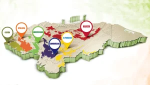
Location
It is located in the center of the country and is its largest city. It is also one of the largest cities in Central America, being the second most populous in the Central American isthmus (with Guatemala being the first).
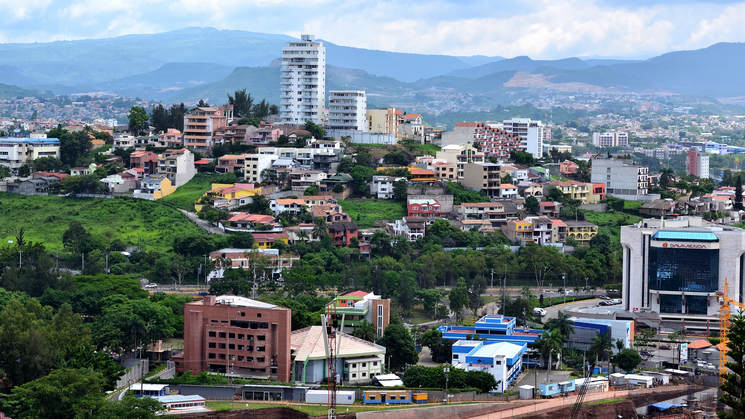
The city of Tegucigalpa is situated on a plateau, at an altitude of about 990 meters (3,248 feet), surrounded by hills. The prominent hill to the north is Cerro El Picacho, which stands at 1,240 meters (4,068 feet) above sea level. The estimated population is 1,826,534 inhabitants (as of 2011).
The Choluteca River crosses the city from north to south, dividing it into two zones: Tegucigalpa to the east and Comayagüela to the west. In 1898, they merged to form the Municipality of the Central District, which is the constitutional seat of the Government of the Republic of Honduras and the Archdiocese of Tegucigalpa.
Tegucigalpa is located in a mountain range at elevations ranging from 935 meters (3,068 feet) at its lowest points to 1,463 meters (4,800 feet) at its highest levels in suburban areas. Like most of the highlands of inland Honduras, the majority of Tegucigalpa’s current surface was occupied by open forests.
The surrounding area continues to support open forest of pine mixed with some oak, scrub, and grassy clearings, as well as needle-leaf evergreen and deciduous broadleaf forests.
Boundaries
The city is bordered to the north by the municipalities of Cedros and Talanga, to the south by the municipalities of Maraita, San Buenaventura, Santa Ana, and Lepaterique, to the east by the municipalities of Santa Lucía, San Antonio de Oriente, Valle de Ángeles, and San Juan de Flores, and to the west by the municipalities of Ojojona, Lepaterique, Lamaní, and San Antonio de Flores.
Tegucigalpa, along with Comayagüela, constitutes the capital of Honduras. The Choluteca River, which crosses the city from north to south, physically separates Tegucigalpa from Comayagüela, with Tegucigalpa located on the right bank of the Grande or Choluteca River, while Comayagüela is in the western sector of the city and near the airport. Both cities are located in the Central District municipality, which is the constitutional seat of the Government of the Republic of Honduras and the Archdiocese of Tegucigalpa.
The city is composed of gentle hills, and the ring of mountains surrounding the city tends to trap pollution. There is a reservoir known as «Embalse Los Laureles» to the west of the city, providing 30 percent of the city’s water supply, as well as a water treatment plant south of the city, around 7.3 kilometers (4.5 miles) from the airport. It is part of the Concepción reservoir, located just 6 kilometers (3.7 miles) southwest of the water plant.
- Elevation: 990 meters above sea level (Toncontín Airport at 1,033 meters above sea level).
- Latitude: 14° 06′ N
- Longitude: 087° 13′ W
Climate
Due to its high elevation above sea level, Tegucigalpa enjoys a pleasant climate. The climate of Tegucigalpa is one of the most enjoyable due to its high altitude. Like much of central Honduras, the city has a tropical climate, though tempered by the altitude, which means it is less humid than lower valleys and coastal regions.
The months of December and January are cooler, while March and April, popularly associated with the Easter holidays, are hotter.
The average number of sunshine hours per month throughout the year is 211.2, and the average number of rainy days per month is 8.9. The average number of sunshine hours during the dry season is 228 per month, while the average monthly precipitation during the wet season is 182.5 millimeters (7.19 inches).
The rainiest months of the rainy season are May-June and September-October, with an average of 16.2 rainy days during those periods.
Economy
Tegucigalpa is the political and economic center of Honduras. The city’s most important economic activities include trade, construction, services, textiles, sugar, electricity, and tobacco.
- 23% Wholesale and retail trade, vehicle repair
- 13% Manufacturing industries
- 9.5% Construction
- 7.1% Public administration and defense, social security schemes
- 5.8% Education
- 42% Other activities
Culture
Tegucigalpa is characterized by its diverse and interesting cultural character. The city has a great cultural value that has been attracting many people in recent decades. It is known for its beautiful colonial and modern style, which makes it a very special place.
The city celebrates several fairs, such as the Tegucigalpa Anniversary Fair on September 29th. This festivity aims to bring out the best of the capital’s residents and is a time of year that always brings much joy and gathering.
Other fairs are also celebrated, such as AGAFAM (Association of Livestock and Agricultural Farmers of Francisco Morazán) Fair, the Horse Fair, and the Entrepreneur Fair.
In Tegucigalpa, there are many cultural centers, including:
- The National Theater Manuel Bonilla is one of the most prestigious institutions in the city. Inaugurated in 1905, its halls host top-level musical and theatrical events. The Manuel Bonilla National Theater has hosted over 10,000 musical, theatrical, and opera performances, with daily shows held throughout the day and night. It also hosts other special events throughout the year. The theater promotes the organization and promotion of high-quality performing arts (theater, dance, and music), both nationally and internationally, with the primary aim of elevating the cultural and spiritual level of the city’s residents.
- Renacimiento Theater.
- National School of Dance «Mercedes Agurcia Membreño» (MAM).
- Danza Libre School.
- National School of Music.
- The National Art Gallery is a place where the love for art can be felt, and its colonial architecture exudes the peaceful ambiance of past eras. From cave paintings and pre-Hispanic stone sculptures to pre-Columbian ceramics, colonial paintings, and religious silver art, visitors can enjoy and admire a true cultural feast. Exploring the facilities of the National Art Gallery in Tegucigalpa is like taking an interesting journey through the history of art in Honduras, in an institution considered a national heritage. The National Art Gallery is the main project of the Foundation for Art and Culture (Fundarte).
- The Auditorium of the National Autonomous University of Honduras.
- Chiminikee (children’s playground and scientific museum for children).
- The Cultural Center of Spain in Tegucigalpa – CCET.
Libraries and Literature
The National Library of Honduras (1880): The National Library of Honduras is a library that houses over forty thousand volumes, fulfilling the dream of its founder, Dr. Antonio Ramón Vallejo, and the aspirations of its sponsor, Secretary of Government under Marco Aurelio Soto, Dr. Ramón Rosa.
The National Library of Honduras is a public utility institution, under the authority of the Secretary of Culture, Arts, and Sports, whose mission is to collect, catalog, classify, preserve, and disseminate all documentary production published in the country and abroad. The National Library of Honduras is located in the former house where General Francisco Morazán was born. This old house also served as the «Mint House» (1780) and in 1830 was used for meetings of the National Congress. Between the years 1859-1876, it served as a barracks, and later in 1898, the National Printing Office was installed. It stopped minting coins in 1926.
The city also has the Library of UNAH (National Autonomous University of Honduras) to support research, teaching, and study, providing access to the necessary information resources, both owned by the University and external to it. The different service points cater to the entire university community and are offered at 10 university centers, each with several faculty libraries, Learning Resource Centers, and specialized museums.
The city has also hosted several «book fairs.»
Museums
The capital of Honduras boasts interesting museums, among which the Villaroy National Museum stands out. Considered a characteristic monument within the urban context of Tegucigalpa, it is renowned for its architectural value. It was constructed between 1936-1940 by Samuel Salgado, with a marked Italian influence and a Paladian architectural scheme. The Museum of the Honduran Man offers visitors three exhibition halls showcasing paintings by Honduran artists, and the Reina Sofía Specialized Art Library, among others. The Miguel Ángel Gómez Restoration Workshop is also operational, where over 400 religious heritage artworks have been restored. This private facility is managed by the Honduran Man Museum Foundation (FMHH). One of the foundation’s greatest achievements is the acquisition of the Ramón Rosa House, the current headquarters of the cultural center, which previously housed the Supreme Court of Justice.
Other notable museums include the Military History Museum located in the San Francisco Barracks building. This museum displays a selection of personal items and photographs of illustrious military heroes and strongmen of Honduras. It also has a hall exhibiting ancient and modern firearms. The Telecommunications Museum aims to preserve the historical heritage represented by different equipment and documentation, as well as the building itself, the Palacio de Telecomunicaciones. Additionally, it contributes to expanding the scientific and cultural knowledge of its employees and Honduran society in general, regarding telecommunications.
The Museum for National Identity (MIN) is a permanent institution open to the public. It is a nonprofit organization serving society and its development. The museum acquires, preserves, researches, communicates, and exhibits material and immaterial evidence of the inhabitants who lived and continue to live in the Honduran territory, with the purpose of strengthening historical memory and national identity.
For those who have not had the opportunity to visit the archaeological site of the Copán ruins, the National Identity Museum houses an auditorium that showcases the main city of the Maya in Honduras: Copán. The Auditorium at the Copán archaeological site in the MIN allows visitors to have an immersive and imaginative experience, transporting them through space and time to the era when Copán was at its peak.
Tourism
La Tigra National Park
It has a total area of 243.406 km2, comprising the core zone and its buffer zone. The park shares boundaries with five municipalities: Distrito Central, San Juan de Flores, Santa Lucía, Valle de Ángeles, and Talanga. Among them, Distrito Central has the largest coverage. The park encompasses four ecosystems: 1. Agro-pastoral system, 2. Lower montane evergreen seasonal needleleaf forest, 3. Lower montane evergreen seasonal mixed forest, and 4. Upper montane evergreen seasonal broadleaf forest. The latter is found at the park’s highest elevations.
The subtropical dry forest is located in the northern zone of the park and covers the smallest area. La Tigra has a wide variety of flora and fauna. Among the vegetation, we can mention tree species such as Ocote Pine, Oaks, Liquidambar, and Avocado Trees, among others. There is also a diversity of ferns, six of which are endangered and protected by AMITIGRA.
Regarding fauna, there are species of mammals, amphibians, reptiles, and birds, which are the most common groups observed within the park. Some of the known animals inhabiting the park include Margays, Agoutis, White-tailed Deer, Night Monkeys, Pumas, and Jaguarundis. There are also various bird species such as Goldfinches, Mountain Turkeys, Quetzals, Hawks, and Toucans, among others.
Metropolitan Zoo of Picacho
Located in Picacho, with an extraordinary view of the city of Tegucigalpa and surrounded by a forest of oaks and pines, the Metropolitan Zoo offers an opportunity to get to know some of the native animals of Honduras.
It features a jaguar, the largest feline in America and native to Honduras, as well as a comprehensive collection of white-tailed deer and spider monkeys. With a total of 310 animals, including 20 different species of mammals, 23 of birds, and 7 of reptiles.
The total area of the zoo is about 22 acres.
Parks
Tegucigalpa is known for its parks, such as:
- La Leona Park where you can appreciate a great and beautiful view of the city. It’s a good place to relax and enjoy the city.
- The Picacho National Park or United Nations Park, which offers an impressive view from its viewpoints. It’s the ideal place to take excellent photographs of the city. In this park, you will also find a small zoo with native species of Honduras and the monument «El Cristo del Picacho». This park was opened to the public on August 2, 1946.
- The Cerro Juan A. Lainez Promenade has been an icon of civic and military history. It is currently an unmistakable symbol of Tegucigalpa with its monument to Peace. It is one of the main viewpoints where you can see the four cardinal points of the city. It is also an ecological lung worth preserving. Recently, a forest firefighter base has been established here. Although it has not been fully developed for tourism as it should be, due to the lack of service and safety conditions, it is still very visited. It is often used as a practice area before patriotic parades and for other types of «quasi-student» practices. Various ceremonies are held here, including cannon firings and flag hoisting for the September and October festivities.
- The Central Park is located in front of the San Miguel Cathedral and is one of the busiest parks in the city. It hosts several activities of great interest and is also a pleasant place to spend time.
- Plaza España (Alfonso XIII Park) is a park and viewpoint that offers ample spaces for rest and recreation, as well as unparalleled views towards the Morazan Boulevard and El Hatillo area. In the center of the octagonal-shaped plaza, there is a statue of His Majesty King Alfonso XIII of Spain.