Hydrography of Honduras – Rivers, lakes and lagoons
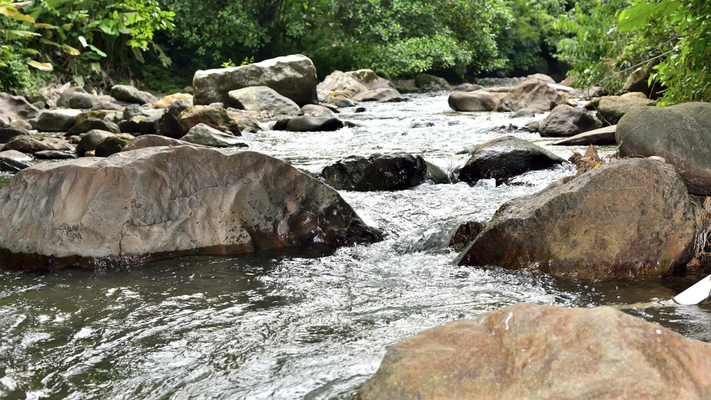
The hydrographic system of Honduras is made up of 19 river systems that originate in the national territory and flow into the Atlantic Ocean (Caribbean) and the Pacific Ocean.
It is divided into Vertiente del Caribe (Atlantic Ocean) and Vertiente del Pacífico .
Thirteen systems flow into the Caribbean Sea slope, with lengths between 550 and 25 km, being the largest and mightiest, whose basins represent 82.72% of the national territory, and six flow into the Pacific slope through the Gulf of Fonseca. systems that represent 17.28%.
Table of contents
Atlantic or Caribbean Sea slope
Rivers of Honduras with their tributaries that flow into the slope of the Caribbean Sea:
- Coco River or Segovia (550 Km)
- Cruta or Kruta River (125 km)
- Nakunta River (65 km)
- Ibantara or Mocorón River (92 km)
- Guarunta or Warunta River (85 km)
- Patuca River (500 km)
- Wampu River
- Guayambre River
- Guayape River
- Rio Tinto
- Talgua River
- Telica River
- Jalan River
- Sicre or Sigre River (70 km)
- Banana River (85 km)
- Sico Tinto Negro River (Red River) (215 Km)
- Sico River
- Paulaya River
- Aguan River (225 km)
- Yaguala River (Mangulile River)
- Papaloteca River (30 Km)
- Cangrejal River (30 Km)
- Leather River
- Lean River (60 Km)
- cloth river
- Ulúa River (300 km)
- Humuya River
- Sulaco River
- White River
- Otoro River (Rio Grande de Otoro)
- Bramble River
- Puringla River
- Jicatuyo River
- Higuito River
- Humuya River
- Chamelecon River (200 Km)
- Motagua River
The Coco or Segovia river is 550 km long and covers an area of 5,684 km². The Patuca River, with its 500 km in length, covers the largest basin (23,511 km²). The second in importance is the Ulúa, covering a basin of 21,964 km² with a length of 300 kilometers in length.
The other giants of the country are the Chamelecón with 200 km long, the Tinto or Negro with 215 km and the Aguán that with its 275 km in length covers a basin of more than 10,523 km². Other no less important rivers on the Honduran Caribbean slope are: Río Plátano (100 km), Cangrejal, Cuyamel and Motagua, which covers an international basin of 2,008 km².
Pacific slope
Rivers of Honduras with their tributaries that flow into the Pacific slope:
- Black River (85 km)
- Choluteca River (Rio Grande or Choluteca) (250 Km)
- Nacaome River (90 Km)
- Goascorán River (115 Km)
- Lempa River
- Torola River (70 km)
- Guarajambala River (75 km)
- Mocal River
- Sumpul River (70 Km)
The main rivers of the slope of the Gulf of Fonseca are few, small, and less abundant compared to those of the Caribbean. The longest is the Choluteca River, which runs 250 km, covering a basin of more than 7,500 km² and an agricultural area of 2,132 km².
Then it is followed by the Goascorán River with 115 km long, covering a basin of 1920 km². The Nacaome is 90 km long and the Negro River 85 km long. The Lempa River on the other hand, covers an international area of 5,612 km².

Lake Yojoa
Secondly; Lake Yojoa is the only natural lake in Honduras, it is located between the departments of Comayagua, Santa Bárbara and Cortés at an altitude of 635 meters above sea level. The lake is located along the San Pedro Sula-Tegucigalpa highway.
It has a perimeter of 50 kilometers and an area of approximately 90 kilometers and is located in an area of high rainfall with an annual average of 3,000 mm. It is approximately 8 kilometers wide, and has a depth of between 18 and 25 meters depending on the season.
In the background you can see the cloudy mountains of Santa Bárbara and Cerro Azul / Meambar. The name of the lake originated from the Mayan words «Yoco-Ha» which means water accumulated on the earth.
It is fed by underground currents that come from the Santa Bárbara and Azul Meambar Mountains, it has three outlets, one visible to the south, the Jaitique River and two underground, the Zacapa River and the Lindo River to the north, which appear through the Peña Blanca Mountain. All of its drainage reaches the Ulúa River.
Lagoons in Honduras
Honduras also has various lagoons; being the most important and of great extension, those of the Atlantic coast: La Laguna de Caratasca, Brus, Ébano and Cris.
Other smaller lagoons are: Laguna de Alvarado located in Puerto Cortés, Ticamaya north of San Pedro Sula, Laguna Quemada and Toloá both located in the department of Atlántida, as well as the Guaymoreto lagoon in Colón, and Jucutuma in La Lima. Cortes department.
-
Caratasca Lagoon: formed by a system of lagoons divided by natural channels. To the south and east of the lagoon are the Warunta, Tansin and Tilbalaca Lagoons, all freshwater because they are fed by the Warunta, Mocorón or Ibantara rivers, and the Cauquira and Cohunta Lagoons. To the west is the Laguna de Tara that flows into the sea through the Tabacunta crique.
The great Laguna de Caratasca is located in the center of the complex of lagoons, it has brackish waters and is separated from the sea by a narrow strip. The lagoon measures 66 kilometers long by 14 wide. The Caratasca lagoon complex has two entrances to the sea, one to the west through Tabacunta and the other through the Barra de Caratasca, 1 kilometer wide and 4 meters deep. -
Brus Lagoon: It is located to the west of the Caratasca Lagoon, separated by the Patuca River. It is 28 km long and 7 km wide and communicates with the sea through the Barra de Brus. To the south of Barra are two small islands.
The Sigre rivers flow into the lagoon, to the east flows a branch of the Patuca River known as Tum Tum Crick. - Laguna de Ebano (Ibans) and Criba: Laguna de Ibans communicates with the small Laguna de Criba to the west. These lagoons communicate with the sea through an entrance channel that measures 500 meters and has a depth of 1.4 meters in the dry season. In front of the Barra de la Laguna is the Cayo or Islote Macedonia. The greatest length of Laguna de Ibans is 12 km. The waters of the Rio Tinto reach the Criba lagoon and are also fed by currents that come down from the Baltimore Mountain. In the Laguna de Ibans there are 6 small islands.
- Guaymoreto Lagoon: Located NE of the city of Trujillo and communicates with the bay through a natural channel through which small boats can enter. Its greatest length is 9 km.
- Laguna Quemada or Laguna de Los Micos: Located west of Tela. It drains to the sea through a natural channel located between the villages of San Juan and Tornabé. It is fed by small rivers that come from the southern mountains.
- Laguna Tinta: Located between Punta Sal and the Río Tinto.
- Ticamaya Lagoon: Located NE of San Pedro Sula, it is a lagoon in the process of advanced succession (dry) caused by human activities in the surroundings.
- Jucutuma Lagoon: It is located 6 km north of the city of La Lima, Cortés. It is 5 km long and 3 km wide.
- Laguna de Toloa: Located at the western end of the Department of Atlántida between Laguna de Los Micos and the Ulúa River. It is 5 km long by 3 km wide and is connected by a channel with the Ulúa River.


