Municipality of Macuelizo
Macuelizo is a municipality in the department of Santa Bárbara in Honduras.
The land titles that today make up the municipality of Macuelizo are dated from the year 1779, with its first partitions being: Hacienda de Sula, Ejidos de Oro y Tarros in 1876. La Laguna Verde, las Minas, and las Cuevas in 1886.
The first news of the foundation of the municipality dates from 1792, the year in which the file instructed about the meeting and new settlement of the Valley of Macuelizo of the jurisdiction of San Pedro Sula was dated; being signed by: the subdelegate judge of the governor’s office, count don José María Cisneros, colonel, Governor Intendente and General Commander of the arms, ordering the royal rents and don Alejo García S.
On July 28, 1794, a letter was sent to the office of the subdelegate of the Party of Chinda, to proceed to delineate the square and streets of said reduction and propose the persons who could be named as mayor and councilmen.
On August 16, 1794, don José María Cisneros, Lieutenant Governor and Subdelegate Intendant of the party of San Pedro Sula, issued an order to don Narciso Rodríguez in order to let him know what had been determined by the private judge of the province, so that he would contribute to the process of «alignment» of the square, streets, and houses. The municipality was then formed, and the description of the first layout of the town was:
- To the south, it borders with quebrada grande
- To the north, down the plain.
- To the East, the royal road to the town of San Marcos.
- To the west, houses of Mr. Narciso Rodríguez.
Once the first census was carried out, it was found that Macuelizo had a total of 30 families, according to the 2013 Electoral Census there are 3,674 inhabitants in the urban area alone.
Location
Macuelizo is located in the southern part of the department of Santa Bárbara. The fundamental economic activity is based on agricultural production: cultivation of basic grains (beans, rice, corn, and coffee), and livestock, as well as general trade. One of the most productive areas is the valley of Quimistán rich in minerals, which are exploited by foreign companies. Macuelizo is a municipality very rich in natural resources.
Among its riches, it has the Culupa River, which produces first quality sand for construction, with many of its inhabitants making use of the artisanal exploitation of this resource. The hauling of sand for the manufacture of concrete blocks is an important resource, as they supply the local and regional construction market. Its waters are used to irrigate the cultivated meadows of basic grains, as well as tobacco, sugar cane, etc. in the summer times.
The lands of this region are rich in precious minerals. Gold deposits have been found in the village of Chiquila, which have been exploited by a foreign company. Explorations have been made in other communities, such as in the Sierra, where iron is presumed to exist, and in the community of La Concordia where antimony is sought.
The passage of the powerful Chamelecon River through this municipality has also been taken advantage of, with a hydroelectric dam being installed on it with a production capacity of 11 megawatts. This energy will be supplied to the National Electric Energy Company of Honduras as soon as they start operating. Also on this same river, at the height of the community of Rio Blanco, another hydroelectric dam is planned to be installed.
The municipality of Macuelizo, is located 307 km from Tegucigalpa, M.D.C. 78 km from San Pedro Sula, 123 km from Puerto Cortes.
The Pan-American Highway strategically crosses the municipality, leaving it well communicated with the Honduran geography.
Borders
The municipality borders to the north with the municipalities of Azacualpa and Nueva Frontera, to the south with the municipalities of Nueva Arcadia, San Luis, and Protección, to the east with the municipalities of Quimistán, San Marcos, and San Luis, and to the west with the municipality of Florida and the Republic of Guatemala.
Villages
- Macuelizo
- Agua Helada
- Aldea Nueva
- Banderas
- Buena VistaEl Cacao
- Buena Vista Flores
- La Libertad or «Callejones»
- Casa Quemada
- Chiquila
- El Barranco
- El Ciruelo
- El Ermitaño
- El Guanacaste
- El Manguito
- El Pital
- El Porvenir
- El Virrey
- El Rosario
- Gracias a Dios
- La Abundancia
- La Cumbre Palmichal
- La Cunta
- La Concordia
- La Ceibita
- La Playa
- Las Delicias
- La Flecha
- La Laguna
- La Vegona
- La Virtud
- Laguna Seca
- Las Delicias
- Las Flores
- Las Minas
- Las Melitas
- La Playa
- Las Alegrías
- Las Varas
- Los Pocitos
- Los Ángeles
- Los Puentes
- Masicales
- Mata de Plátano
- Ojos de Agua
- Piñuelas
- Pueblo Nuevo
- Río Blanco
- Sabanetas
- San Antonio de La Cumbre
- San Antonio de Macuelizo
- San Antonio De Chiquila
- Seis de Mayo
- Pozas Verdes
- Sula
- Valle Verde
- Zapotalito.
Culture
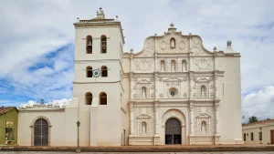
The people of Macuelizo are known for being a peaceful and friendly society. Its patronal feast is celebrated in the month of September in honor of Saint Michael Archangel (day 29) with religious activities, traditional parades of floats and horses, as well as tape races carried out on horseback.
Infrastructure
The municipality has electricity service in almost all its villages and potable water service in its entirety. The municipal head and the nearby villages have telephone service.
There is the «Pompilio Ortega» Agricultural School, where professionals are prepared with secondary education in agriculture, which are a good alternative for local development and the valleys of Quimistán.
Immigration
Due to the lack of investment in the manufacturing industry, a large part of the young population has migrated to the cities in search of a job opportunity in the maquilas; while others are employed in agricultural and livestock tasks.