Department of Yoro
Yoro is one of the 18 departments of the Republic of Honduras.
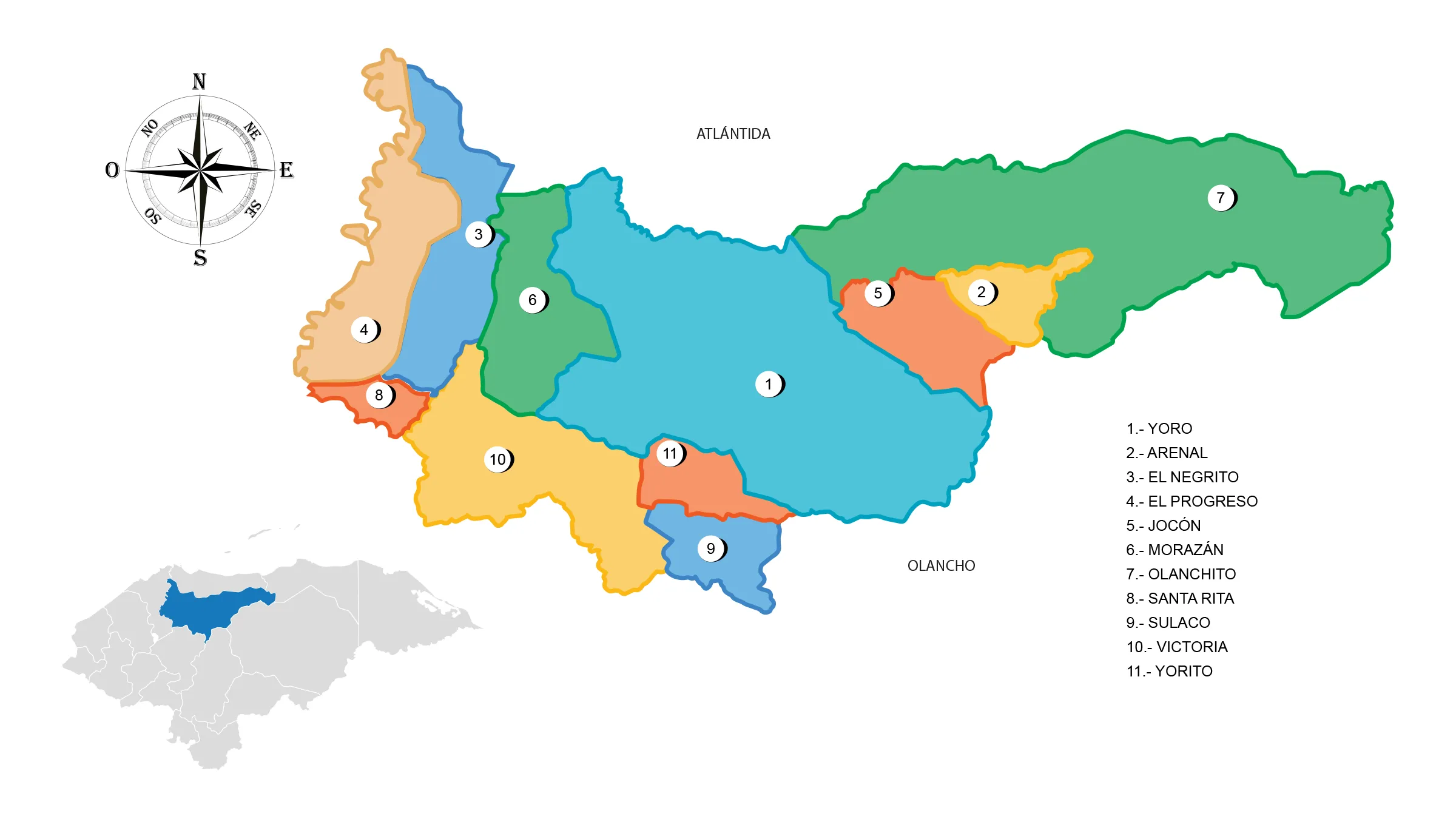
View Map of Department of Yoro
General Information
It was one of the first 7 departments that were established in the initial political division of Honduras in 1825, along with Comayagua, Santa Bárbara, Tegucigalpa (now Francisco Morazán), Gracias (now Lempira), Choluteca, and Olancho.
History
Once the State of Honduras was declared, with the Licentiate Dionisio de Herrera as its first Supreme Chief of State, the Honduran territory was divided for the first time according to the 1825 Constitution. As a result, the department of Yoro was recognized and created.
In the First Political Division of Honduras in 1825, the department of Yoro encompassed the territory currently occupied by the departments of Atlántida, Colón, and Gracias a Dios.
In the Fifth Political Division of 1881, with the creation of the department of Colón, Yoro lost part of its northwestern territory, including Trujillo, Balfate, Iriona, Juticalpa, El Porvenir, and La Ceiba.
In the Eighth Political Division of 1902, with the creation of the department of Atlántida, Yoro lost all its territory along the Atlantic Coast. The municipalities of Jutiapa, El Porvenir, and La Ceiba became part of the newly created department of Atlántida.
Geography of Yoro
Located in the central-northern region of the country, this department has an area of 7,781 km2 and extends between 14o 51′ and 15o 43′ north latitude and 86o 14′ and 87o 56′ west longitude.
Boundaries
The department of Yoro shares borders with 6 departments:
- North: with the department of Atlántida (Honduras).
- South: it borders the departments of Comayagua and Francisco Morazán (department).
- East: it is located near Olancho and Colón (Honduras).
- West: it borders only with the department of Cortés (Honduras).
Municipalities of Yoro
See List of Municipalities of Honduras
- Yoro 1801
- Arenal 1802
- El Negrito 1803
- El Progreso 1804
- Jocón 1805
- Morazán 1806
- Olanchito 1807
- Santa Rita 1808
- Sulaco 1809
- Victoria 1810
- Yorito 1811
Protected areas: Pico Pijol National Park, Montaña de Yoro National Park, Texiguat Wildlife Refuge. Rivers: Ulúa River, Sulaco River, Comayagua River, Aguán or Romano River, Cuyamapa River, Guayma or Yaguala River.
Economy of Yoro
The economy of Yoro is based on agricultural, livestock, and industrial activities developed under the enclave economy model promoted by North American fruit companies.
Cocoa, sugarcane, corn, beans, cattle, and bananas, among others, are some of the products that sustain the economy of Yoro.
Rain of Fish
A curious phenomenon that occurs in the department of Yoro is the so-called «Rain of Fish,» which takes place in the months of May and June each year.
Deputies of Yoro
The department of Yoro has a representation of 9 deputies in the National Congress of Honduras.
Deputies to the National Congress of Honduras for the period 2018-2022:
- Milton Puerto – National Party
- Marco Gámez – National Party
- Gabriel Rubí – National Party
- Eder Mejía Yoro – National Party
- Marco Tinoco – Libre Party
- Irma Reyes – Libre Party
- José Portillo – Liberal Party
- Juan Tejeda – Liberal Party
- Dunia Ortiz – Patriotic Alliance Party


