Municipality of Villanueva
Villanueva is a municipality in the department ofCortés, Honduras.
According to tradition, this town was founded by settlers from Santa Bárbara who built their homes at a place called «Llano Viejo,» located south of its current location. Due to the scarcity of water, that place was abandoned and the town was relocated to its present site. It was established as a municipality on August 23, 1871, during the government of José María Medina.
General Information about Villanueva
Origin of its name: Cultural name for a new settlement.
- Date of creation: August 23, 1871
- Territorial area: 358.90 km2
- Altitude: 23 meters above sea level
- Patron Saint Festival: August 24 to September 1, in honor of St. Ramón
- Administrative Code (Geocode): 0511
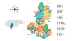
- Villages: 20
- Hamlets: 221
History
According to tradition, this town was founded by settlers from Colinas, Trinidad, San Nicolás, and Celilac in Santa Bárbara, who built their homes at a place called Llano Viejo, located south of its current location. Due to the scarcity of water, that place was abandoned and the town was relocated to its current site.
In 1801, it appeared as a settlement of Tehuma (San Manuel). It was established as a municipality on August 23, 1871, by agreement of the Political Governor of the Department of Santa Bárbara.
In 1940, the Local District of Villanueva was created, comprising the current municipality of Villanueva. However, in 1957, municipal autonomy was restored.
Location
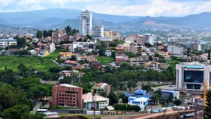
This municipality is located in the center of the Cortés department, 25 kilometers from the city of San Pedro Sula and 232 kilometers from the capital city, Tegucigalpa. It is situated in the Sula Valley, with its headquarters located to the west of the Ulúa River.
View on Google Maps
Limits
- North: municipality of San Pedro Sula;
- South: municipalities of Potrerillos and San Antonio de Cortés;
- East: municipalities of Pimienta and San Manuel;
- West: municipalities of Concepción del Norte and Petoa (both in Santa Bárbara).
Topography
The terrain has steep slopes in 50.7% of the area, where forests predominate. 14.5% of the hilly slopes are used for permanent crops and seasonal harvests suitable for the region’s climate and soil. The remaining 34.8% consists of gently undulating plains with intensive cultivation.
Orography
- Jasta Mountain
- La Zorra Hill (652m), Agua Dulce Hill, El Casposo Hill, Machia Hill, Ocotalitos Hill
Flora and Fauna
- Forests of coniferous mountains and mixed forests in the coastal plain
- Mammals: Shrew, squirrel, coati, raccoon, skunk, white-nosed coati, deer, agouti, tapir, wild boar, coyote, foxes, wildcat, puma, ocelot, and jaguar.
- Birds: Woodpecker, ocote dove, roadrunner, great-tailed grackle, seagull, pelican, common ground dove, parakeet, turquoise-browed motmot, thrush, heron, hawk, vulture, owl, and fishing eagle.
Population
It has a total population of 149,977 inhabitants, of which 72,503 are males and 77,473 are females. 124,831 live in the urban area and 25,146 live in the rural area. It ranks #3 in the department, with 9.6% of the population, and #8 in the country, with 1.8% of the total population. 2.0% of the population belongs to an ethnic group. In the past 10 years, 1,394 people have emigrated and live in another country.
In this municipality, there are 85,685 individuals aged 18 and older, of which 93% have their identification card. The municipality has an illiteracy rate of 9.6% and primary school coverage of 92%, with an average of 6.6 years of schooling. Female heads of households represent 28% of the households. The sex ratio is 94 males per 100 females, and the elderly population (65+ years) represents 3.2% of the population.
Economy
- 43% Manufacturing industries
- 15% Wholesale and retail trade, vehicle repair
- 11% Agriculture, livestock, forestry, and fishing
- 7.1% Construction
- 4.8% Transportation and storage
- 19% Other activities
Agriculture
- Sugarcane, Banana, Plantain, Citrus fruits, Cocoa, Coconut, Spices, Pepper, Soybean, Basic grains
Livestock
- Cattle, Pigs, Horses
Industry
The industrial productive corridor has around 105 companies divided into four industrial parks: ZIP Villanueva, ZIP Buena Vista, Zip Chamelecón, and ZIP Búfalo. These parks employ over forty thousand people from the municipality and surrounding areas. Currently, there are 20 industries dedicated to the production of sugar, poultry, pork, beef, as well as oils, flours, textiles, plastics, purified water, metal products, fiber products, animal feed, concrete products, distilleries, heavy equipment distributors, and lime products.
Tourism
El Ocote Eco-Tourism Park
Located 7 km from Villanueva, Cortés in the village of El Ocote. It covers an area of 90 hectares, with 80 hectares designated as a forest reserve and the remaining 10 hectares hosting the tourist complex.
Las Ventanas – The Mysterious Caves
Las Ventanas is a tourist site in Villanueva, Cortés, situated in the southern part of the municipality. It is located in the village of El Cutuco in a mountainous area with abundant vegetation. Within a protected green area, you can find one of the largest caves in Honduras. These caves have existed since pre-Columbian times.
To reach the caves of Las Ventanas, you must traverse a path with many obstacles, including climbing a mountain with a height of 300 to 500 meters. It is advisable to bring at least a rope for climbing and descending, a flashlight, a machete, and plenty of water if possible.