Map of the Department of Ocotepeque
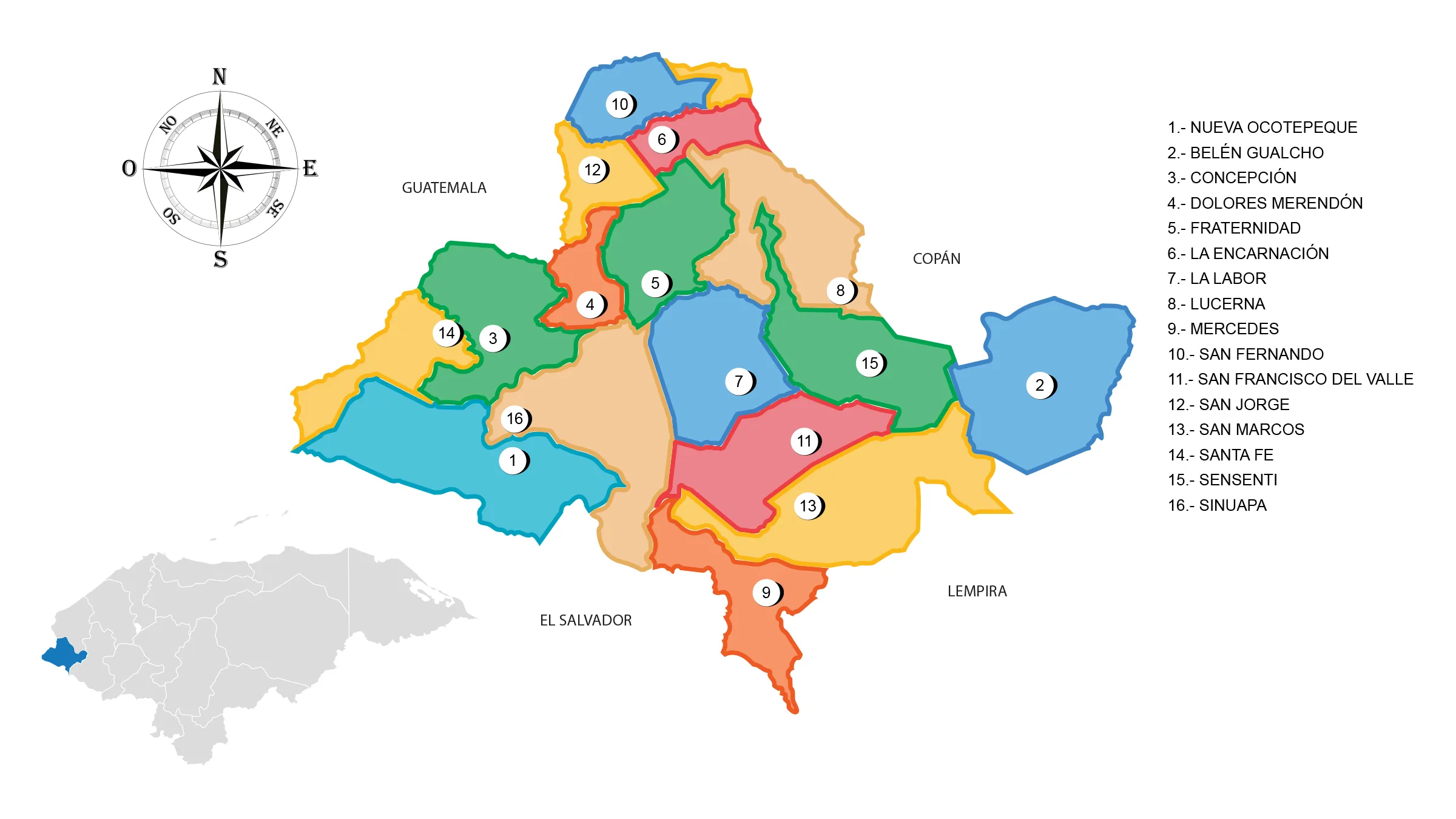
The Ocotepeque Department is located in the westernmost part of the country. It has a territorial area of 1,630 km².
The first inhabitants of the department were the chortis, a subgroup of the Mayan culture of western Honduras, with a slight extension towards the Republic of Guatemala.
Limits
- North: Copán Department
- South: Republic of El Salvador
- East: Lempira Department
- West: Republic of Guatemala.
Municipalities
See List of Municipalities of Honduras
- Nueva Ocotepeque Cabecera departamental
- Belén Gualcho
- Concepción
- Dolores Merendón
- Fraternidad
- La Encarnación
- La Labor
- Lucerna
- Mercedes
- San Fernando
- San Francisco del Valle
- San Jorge
- San Marcos
- Santa Fe
- Sensenti
- Sinuapa