The Central Cordillera of Honduras
The Cordillera Central is a region dominated by medium-sized mountains, with an average elevation of 1,400 meters above sea level (masl), creating a pleasant climate for most of the year. It includes the following mountain ranges: El Gallinero, Atima, Montecillos, Comayagua, Mico Quemado, Sulaco, Misoco, Agalta, Punta Piedra, and La Esperanza.
«The Sierra del Gallinero extends from the Department of Copán, starting from the headwaters of the Gila River, between the municipalities of La Unión and Cabañas, and crosses the departments of Copán and Santa Bárbara until reaching the municipality of Concepción del Norte. The Santa Rosa plateau, where the city of Santa Rosa de Copán is located, is situated here.»
See also Mountains of Honduras
«The Sierra de Atima is located with a southwest to northeast orientation, starting from the Joconal Mountain north of the municipality of Lepaera, Lempira, and crosses the entire Department of Santa Bárbara until it ends near Villanueva, Cortés.» The Sierra de Montecillos extends from the department of Cortés and passes through Comayagua until it reaches the department of La Paz. «In the Montecillos range, you can find the mountains of Meámbar, Maroncho, and La Nieve. The highest elevation reaches 2,744 masl precisely at Pico Maroncho.» «At the eastern base of the Montecillos range, where the interruption of the mountain ranges is complete, lies the plain of Comayagua.»
The Sierra de Comayagua is located in Comayagua and is separated to the north by the Sulaco Valley and to the south by Amarateca, which separates it from the Hierbabuena Mountain in Francisco Morazán to the south of the town of Talanga. In its northern extension, the towns of Minas de Oro, Esquías, and San Luis (Comayagua) are located.
«The Sierra de Mico Quemado is located to the west of the Department of Yoro, and it refers to the mountains located on the eastern front of the city of El Progreso. It is delimited by the Ulúa or Sula River Valley to the west, the Humuya River to the south, the Olomán Valley drained by the Cuyamapa River to the east, and the Guaymas River, which is a tributary of Toloa Lagoon, to the north.»
The Sierra de Sulaco is located «east of the high mountains of Comayagua, past the Sulaco River and valley, reaching this group of tall mountains located almost in the center of Honduras and where very important rivers originate, running towards the Atlantic, such as the Aguán or Romano River, and other less important ones that flow south. It is a mountain range of short extension, about 60 km from east to west.» «Among its main mountains is Pico Píjol, whose peak reaches 2282 masl, forming part of the highest peaks in the country.»
The Sierra de Misoco and Almendarez partially serve as a border between the Departments of Francisco Morazán and Olancho, extending from northwest to southeast. A branch of the range is located in the northern part of the Department of Francisco Morazán, forming the group of the La Flor Mountains. It is bordered to the north by the Guayape River Valley and to the south by the Jalán River Valley. The mountains of El Chile belong to this Sierra, located south of the Jalán River, connecting to the east with the mountains of Villa Santa and Azacualpa. Among the main mountains that make up this range are Montaña La Flor, Misoco, Almendáres, Neblinas, La Lona, Jaboncillal, Maracunda, Carrizo, El Derrumbe, and Conventos.»
The Sierra de Agalta extends from southwest to northeast between the departments of Olancho and Colón. In this range, you can find the mountains of Boquerón, separated by the Telica River Valley, and the mountains of San Pablo, located between the Sico and Paulaya Rivers, also known as Río Tinto.
In its southwest part, two foothills can be observed: one coming from the Macupina Mountain between the municipalities of La Unión and Esquipulas del Norte, and the other from the Boquerón and La Cecilia Mountains, on the side of the municipalities of Guayape and Salamá. The La Muralla National Park is located in the Los Blancos Mountain. The main mountains of the Sierra de Agalta include Fray Pedro, Aguacate, and Zapotillo, forming the core of the range.
Sierra Punta Piedra: It is located between the departments of Gracias a Dios and Colón, orienting from east to west. The main mountain of Punta Piedra was arched by an intrusive batholith that emerges in a steep gorge of the Wampú River. The mountains of Río Plátano are part of this range.
Sierra de La Esperanza: It extends from southwest to northeast and serves as a partial dividing line between the Departments of Olancho-Yoro and Olancho-Colón. Its foothills to the northeast extend towards Cabo Camarón on the northern coast. This range includes mountains such as Cerro Azul de Botaderos, with an elevation of 1433 masl, and La Esperanza, with an elevation of 1075 masl.
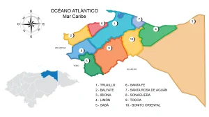
Other mountains include Aguacatal and Jaguaca, south of Sabá, as well as Piedra Blanca and Paya, south of Limón in Colón. The Sierra de La Esperanza runs parallel to the hydrographic basins of the Sico and Aguán Rivers, serving as a watershed for both basins. It ends near the coast at Cerro Sangrelaya, with an elevation of 1800 masl, south of Iriona.
See also Geographical Regions of Honduras