Municipality of El Progreso
The city and municipality of El Progreso is a city and municipality in the Department of Yoro, in the Republic of Honduras.
Currently, it is the third most populous city in Honduras and ranks among the top 5 cities with the highest labor and commercial activity in the country. It also has a perfect geographical location, as 30 percent of its active workforce travels and works daily in San Pedro Sula, Villanueva Choloma, and other neighboring cities such as La Lima and Tela.
Origin of the name
For a long time, it was called «Santa María de Canaán del Río Pelo,» and then due to the rapid development of the municipality in terms of population, work, and infrastructure, it was also called «El Progreso» in honor of Mr. Juan Blas Tobias, an important figure of the time, who was from El Progreso (Yucatán) and in honor of his hometown.
Location
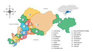
The municipality is located in the Department of Yoro, in the Republic of Honduras. Its geographical boundaries are as follows: to the north, it borders the city of Tela in the Department of Atlántida; to the south, it borders the municipality of Santa Rita in the Department of Yoro; to the east, it borders the municipality of El Negrito in the Department of Yoro; and to the west, it borders the municipality of San Manuel in the Department of Cortés.
Due to its strategic location, almost all land travelers or tourists have the need or obligation to pass through the city of El Progreso in one way or another. For this reason, it is commonly referred to as «La Perla del Ulúa» and is considered a city of extreme importance in Honduras.
From there, travelers make connections to San Pedro Sula, Tela, Santa Rita, El Negrito, Morazán, Yoro, Olanchito, Colón, La Ceiba, Olancho, La Lima, Santa Cruz de Yojoa, Comayagua, Tegucigalpa, and also benefit from its proximity to the Ramón Villeda Morales International Airport.
Additionally, there is an exit to the north of the city that passes through the village of San José and reaches the municipality of El Negrito, traversing the Mico Quemado mountain. Another important exit is through the Banana Fields of El Progreso, which leads directly to the village of Baracoa, belonging to the municipality of Puerto Cortés in the Department of Cortés.
The city covers an area of 547.5 km². Of this territory, 40.51 km² is purely urban, and 506.99 km² is rural.
The climate of the city is humid, with temperatures ranging from 18 to 36 °C. The city is divided into three geographical zones and has more than 180 neighborhoods and colonies, with an urban population of approximately 200,000 inhabitants.
Economy
One of its main sources of employment is the maquiladora industry, with the majority of them located in the El Porvenir ZIP code.
Due to the recent commercial boom, the city of El Progreso has become the third most important city in Honduras. As a result, the Honduran government is helping improve the infrastructure of this city, although it is still not enough to support this significant commercial activity.
Mico Quemado
Deforestation and fires are serious problems in Mico Quemado.
The Mico Quemado Mountain Range is one of the attractions of the city of El Progreso. It is located to the east of the city, facing the great Sula Valley. More than 28,000 hectares of this mountain range are protected by the central government of Honduras due to its ecological richness, as it is home to a large number of exotic plants and animals. The area is also important for the city’s inhabitants, as it is the origin of the water system that supplies the population.
Ulúa River
The Ulúa River is one of the largest and most important rivers in Honduras. It originates in the department of Intibucá under the name Río Grande de Otoro. The Ulúa flows through the departments of Santa Bárbara, Cortés, Yoro, and Atlántida, where it is fed by the Higuito, Mejocote, Lindo, Jicatuyo, Humuya or Comayagua, and Sulaco rivers, as well as many streams that contribute to its development over a length of about 400 kilometers. Due to its high water volume, the Ulúa River can also be dangerous, as it tends to experience significant increases in its flow during cyclones or heavy rainfall, causing damage to settlements or cities in its path.