Map of the Department of Comayagua
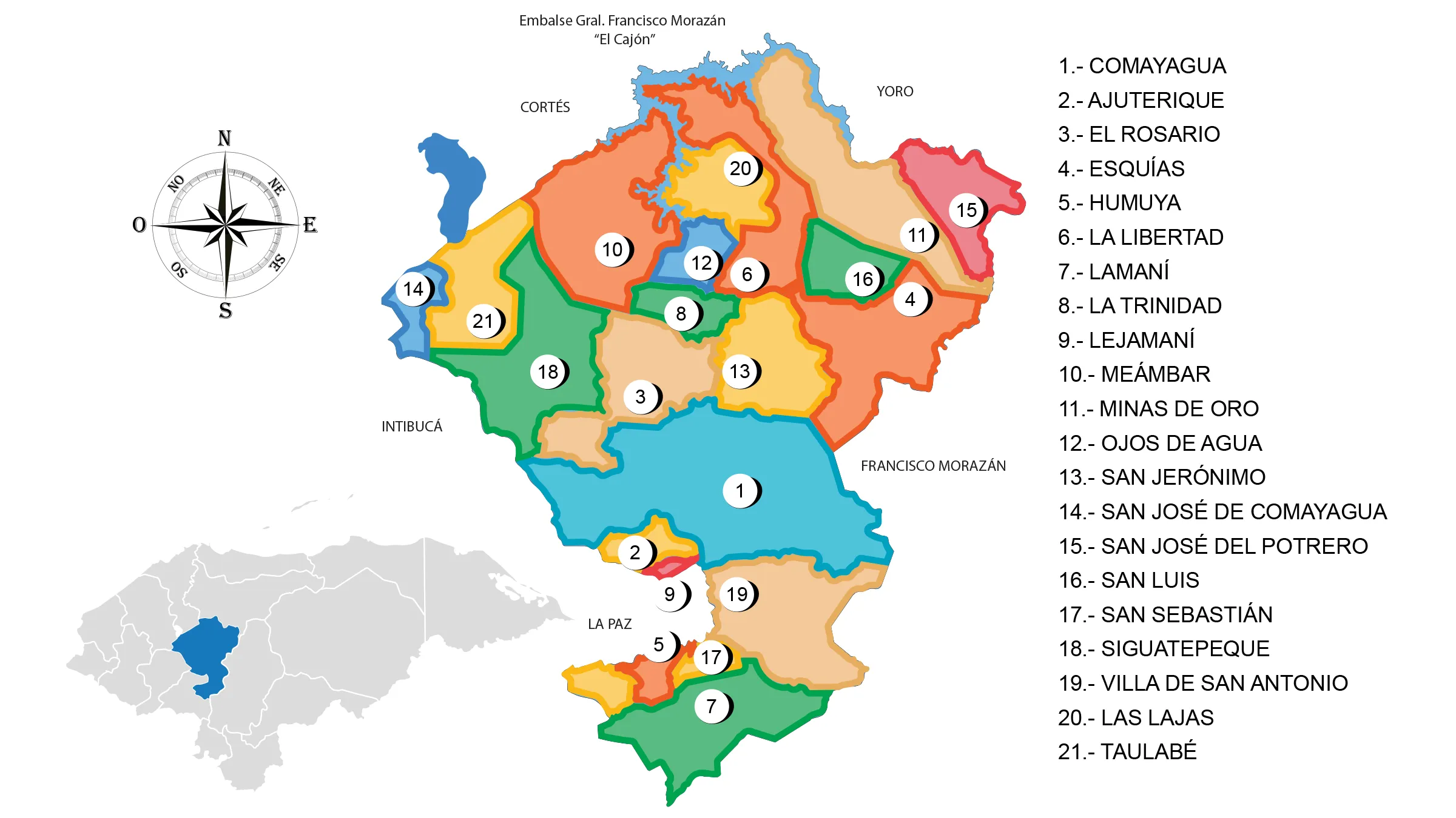
The Comayagua Department is located in the central part of the country. It has a territorial area of 5,124 km².
During almost the entire Colonial Period, Comayagua was the most important political center of the province and even part of the post-independence period. It ceased to be the capital on October 30, 1880 and was moved to Tegucigalpa.
Limits:
- North: departments of Cortés and Yoro;
- Sur: departments of La Paz and Francisco Morazán;
- East: department of Francisco Morazán;
- West: departments of Intibucá and Santa Bárbara.
Municipalities of Comayagua
See List of Municipalities of Honduras.
- Comayagua
- Ajuterique
- El Rosario
- Esquías
- Humuya
- La Libertad
- Lamaní
- La Trinidad
- Lejamaní
- Meámbar
- Minas de Oro
- Ojos de Agua
- San Jerónimo
- San José de Comayagua
- San José del Potrero
- San Luis
- San Sebastián
- Siguatepeque
- Villa de San Antonio
- Las Lajas
- Taulabé