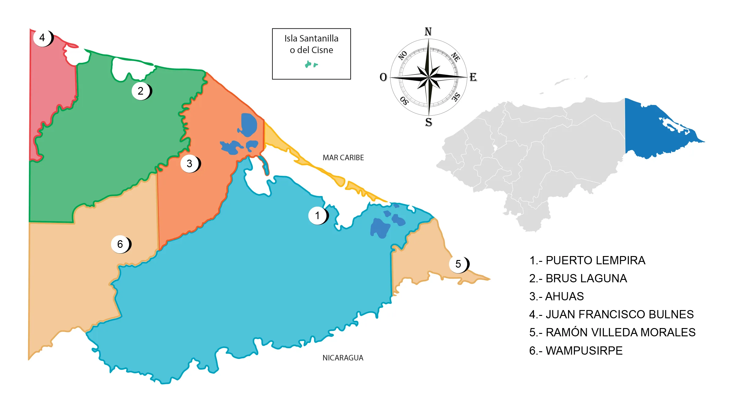
Map of the Department of Gracias a Dios

The Department of Gracias a Dios is located to the north with the Republic of Nicaragua and to the west with the departments of Colón and Olancho. It has a territorial surface of 16,997 km².
In the department there are reserves, biospheres and the Plátano River, true sources of oxygen and water.
Limits
- North: Sea of the Antilles;
- South: Republic of Nicaragua;
- East: Sea of the Antilles;
- West: departments of Olancho and Colón.
Municipalities of Gracias a Dios
See List of Municipalities of Honduras


