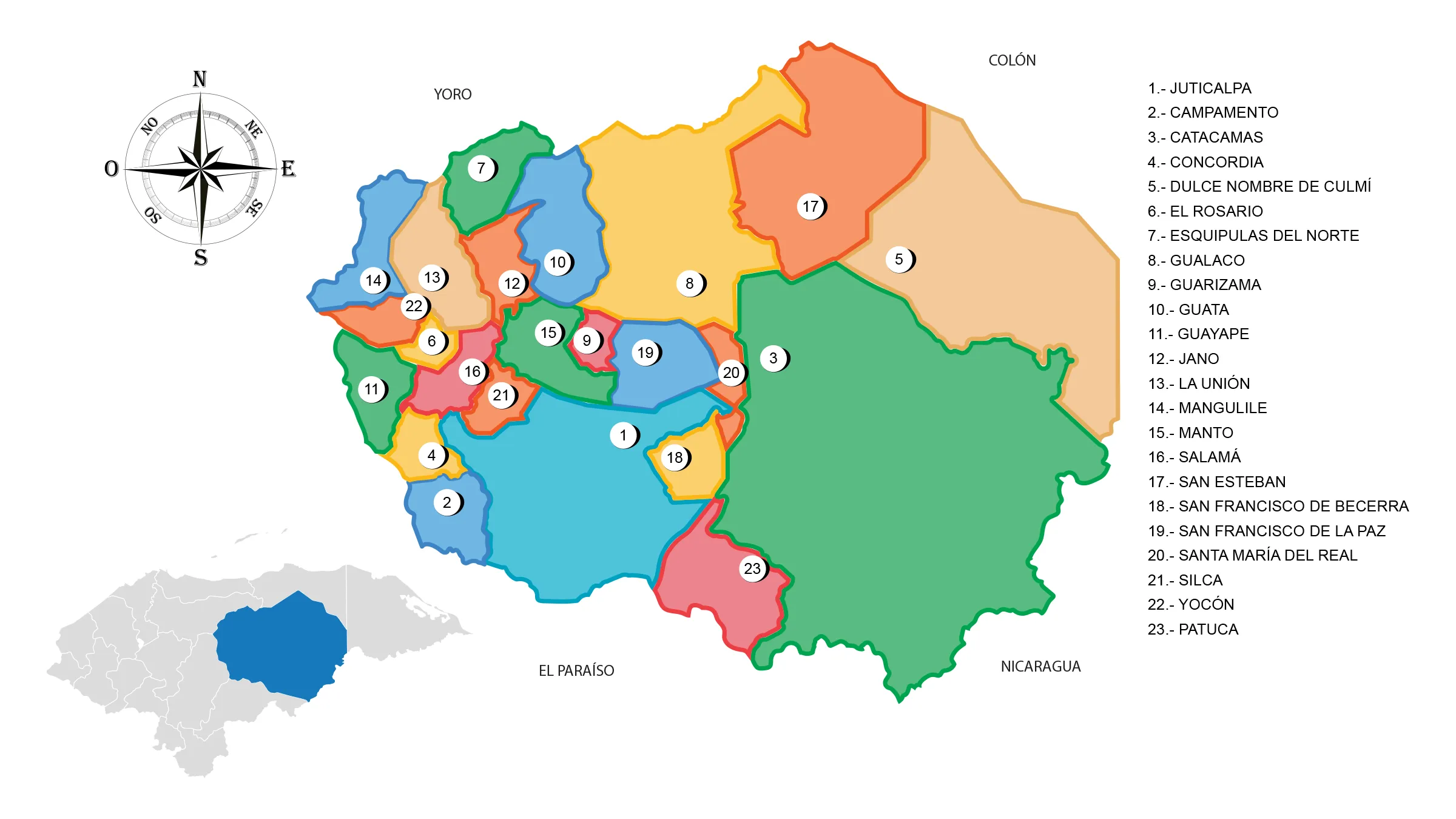
Map of the Department of Olancho

The Olancho Department is located in the northeastern part of the country. It has a territorial area of 23,905 km².
It has a larger territorial extension than the neighboring republics of El Salvador and Belize; being the second subnational entity of Central America by territory after Petén in Guatemala. This department was created on June 28, 1825.
Boundaries
- North: Departments of Yoro and Colón
- South: Department of El Paraíso and Republic of Nicaragua
- East: Department of Gracias a Dios and Republic of Nicaragua
- West: Departments of El Paraíso and Francisco Morazán.
Municipalities
See List of Municipalities of Honduras
- Juticalpa
- Campamento
- Catacamas
- Concordia
- Dulce Nombre de Culmí
- El Rosario
- Esquipulas del Norte
- Gualaco
- Guarizama
- Guata
- Guayape
- Jano
- La Unión
- Mangulile
- Manto
- Salamá
- San Esteban
- San Francisco de Becerra
- San Francisco de la Paz
- Santa María del Real 1520
- Silca
- Yocón
- Patuca


