Map of the Department of Yoro
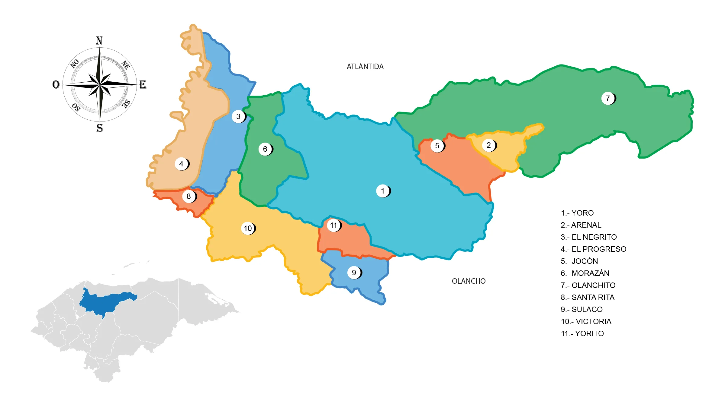
The Yoro Department is located in the central-northern region of the country. It has a territorial area of 7,781 km².
In the First Political Division of Honduras in 1825, the department of Yoro included all the territory currently occupied by the departments of Atlántida, Colón and Gracias a Dios.
Limits
- North: with the department of Atlántida (Honduras).
- South: borders the departments of Comayagua and Francisco Morazán (department).
- East: are located: Olancho and Colón (Honduras)
- West: borders only with the department of Cortés (Honduras).
Municipalities
See List of Municipalities of Honduras
- Yoro 1801
- Arenal 1802
- El Negrito 1803
- El Progreso 1804
- Jocón 1805
- Morazán 1806
- Olanchito 1807
- Santa Rita 1808
- Sulaco 1809
- Victoria 1810
- Yorito 1811