Municipality of Santa Maria
The municipality of Santa María belongs to the Department of La Paz.
In Vallejo’s statistical yearbook of 1889, the founding date is recorded as 1844, and it became a municipality in 1870, during the presidency of José María Medina. In the 1887 census, it is assigned to the district of Marcala, always within the jurisdiction of the Department of La Paz.
General Data of Santa María
Origin of its name: Of religious nature.
- Territorial area: 99.20 km2
- Population: 10,205 inhabitants (2012)
- Date of creation: 1870
- Patronal festival: August 15th, day of the Virgin of the Assumption.
- Villages and hamlets: 8 villages and 40 hamlets.
- Altitude: 1160 meters above sea level.
Main Economic Activity
Cultivation of basic grains, coffee, sugarcane, citrus fruits, cardamom, grapes, and vegetables; cattle, horse, and goat breeding; poultry farming.
Infrastructure
- Health: 4 CESAR.
- Education: 71 primary education centers and 24 pre-primary education centers.
Location
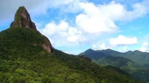
Located in a narrow valley surrounded by ocotillo trees, near the Saragua River, 64 km from the city of La Paz.
Limits
- North: municipality of Santiago de Puringla;
- South: municipalities of Guajiquiro and Chinada;
- East: municipality of San Pedro de Tutule;
- West: municipalities of San José and Masaguara (Intibucá).
Hydrography: Saragua, Achiote, Cañas, Lepasale, and Negro rivers.