Map of the Department of El Paraiso
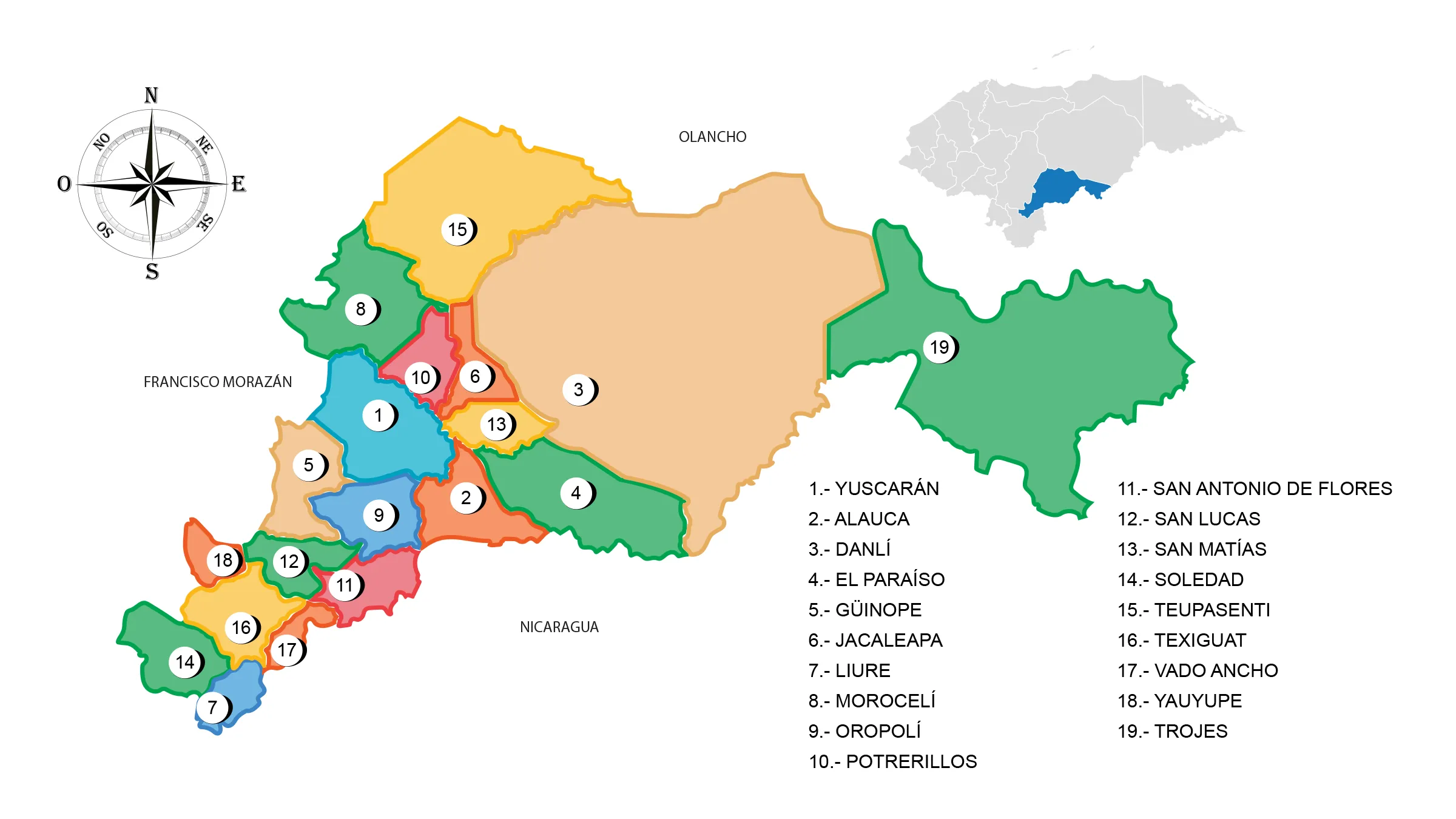
The El Paraíso Department is located in the east of the country. It has a territorial surface of 7,489 km².
It was created during the government of José María Medina in 1869 together with the departments of La Paz and Copán. One of the most active industries is the distillation of liquor, as well as modest mining exploitation, local products such as melon, tobacco and corn.
Boundaries
- North: Olancho department
- South: Choluteca department and the Republic of Nicaragua
- East: Republic of Nicaragua
- West: Francisco Morazán department.
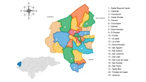
Municipalities
See List of Municipalities of Honduras
- Yuscarán
- Alauca
- Danlí
- El Paraíso
- Güinope
- Jacaleapa
- Liure
- Morocelí
- Oropolí
- Potrerillos
- San Antonio de Flores
- San Lucas
- San Matías
- Soledad
- Teupasenti
- Texiguat
- Vado Ancho
- Yauyupe
- Trojes