Map of the Department of Copán
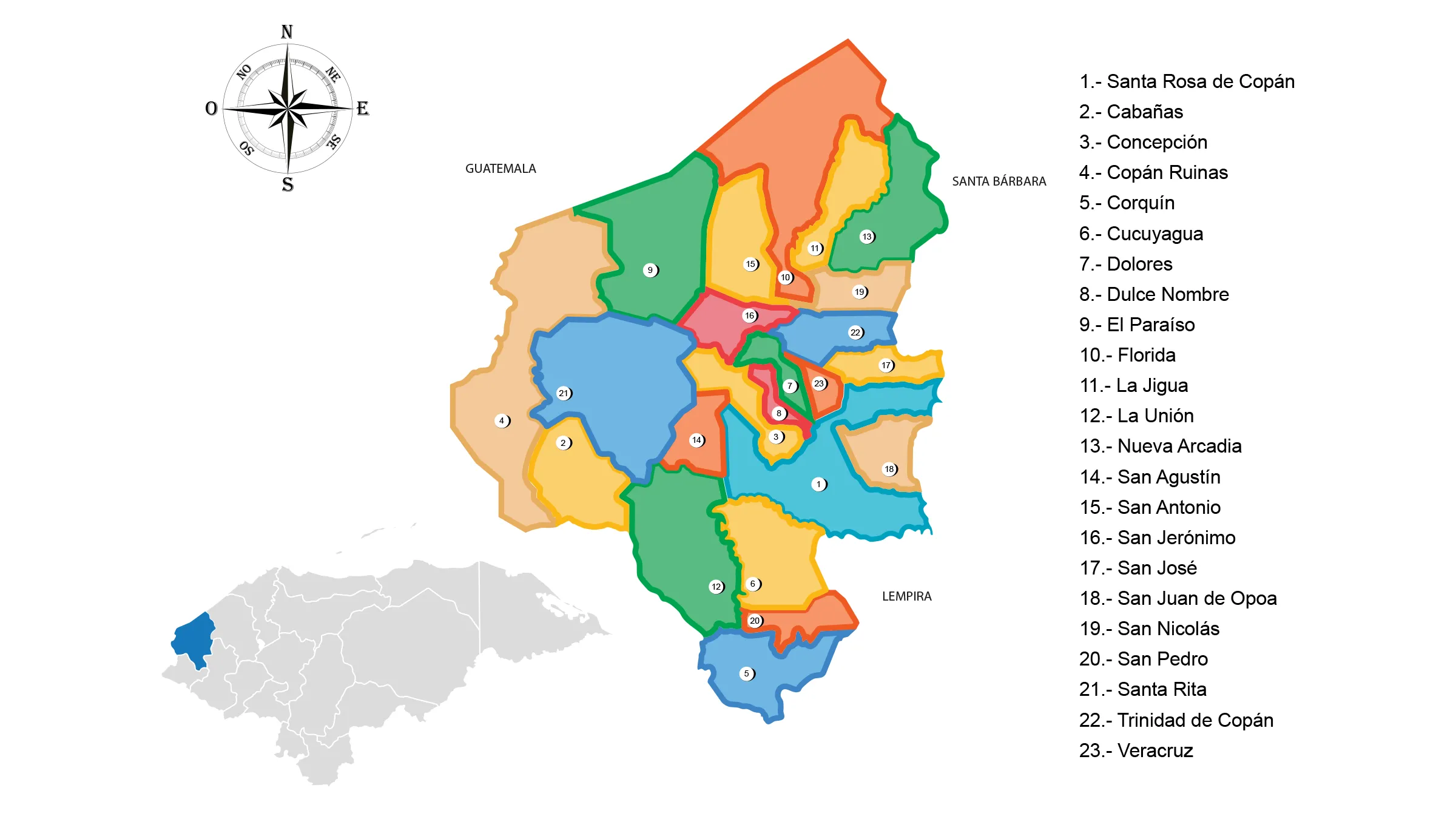
The Copan Department is located in the western part of the country. It has a territorial surface of 3,242 km².
The original inhabitants of the department were the Mayans and Chortís organized in tribes and chiefdoms; the Mayans founded the city of Copán on the banks of the Copán River, in a valley of very fertile land. The alliance of the Mayans with a Chortí lordship put into development a very important culture of the pre-hispanic era of Honduras.
Limits
- North: Republic of Guatemala
- South: Department of Ocotepeque
- East: Departments of Santa Bárbara and Lempira
- West: Republic of Guatemala.
Municipalities of Copán
See List of Municipalities of Honduras
- Santa Rosa de Copán
- Cabañas
- Concepción
- Copán Ruinas
- Corquín
- Cucuyagua
- Dolores
- Dulce Nombre
- El Paraíso
- Florida
- La Jigua
- La Unión
- Nueva Arcadia
- San Agustín
- San Antonio
- San Jerónimo
- San José
- San Juan de Opoa
- San Nicolás
- San Pedro
- Santa Rita
- Trinidad de Copán
- Veracruz