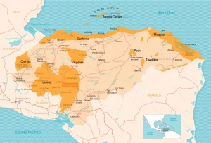
Map of the Department of Intibucá
The Intibucá Department is located in the western part of the country. It has a territorial area of 3,123 km².
The existence of the department dates back to the 19th century when the political governor José María Cacho drew up a map of western Honduras based on it to divide such a vast region into several departments.
Boundaries
- North: departments of Comayagua, Lempira and Santa Bárbara.
- South: Republic of El Salvador.
- East: departments of Comayagua and La Paz.
- West: department of Lempira.
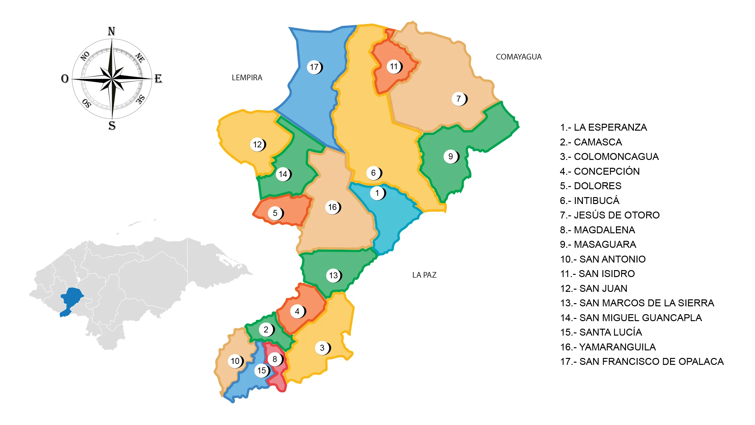
See List of Municipalities of Honduras
- La Esperanza
- Camasca
- Colomoncagua
- Concepción
- Dolores
- Intibucá
- Jesús de Otoro
- Magdalena
- Masaguara
- San Antonio
- San Isidro
- San Juan
- San Marcos de la Sierra
- San Miguel Guancapla
- Santa Lucía
- Yamaranguila
- San Francisco de Opalaca