Map of the Department of Lempira
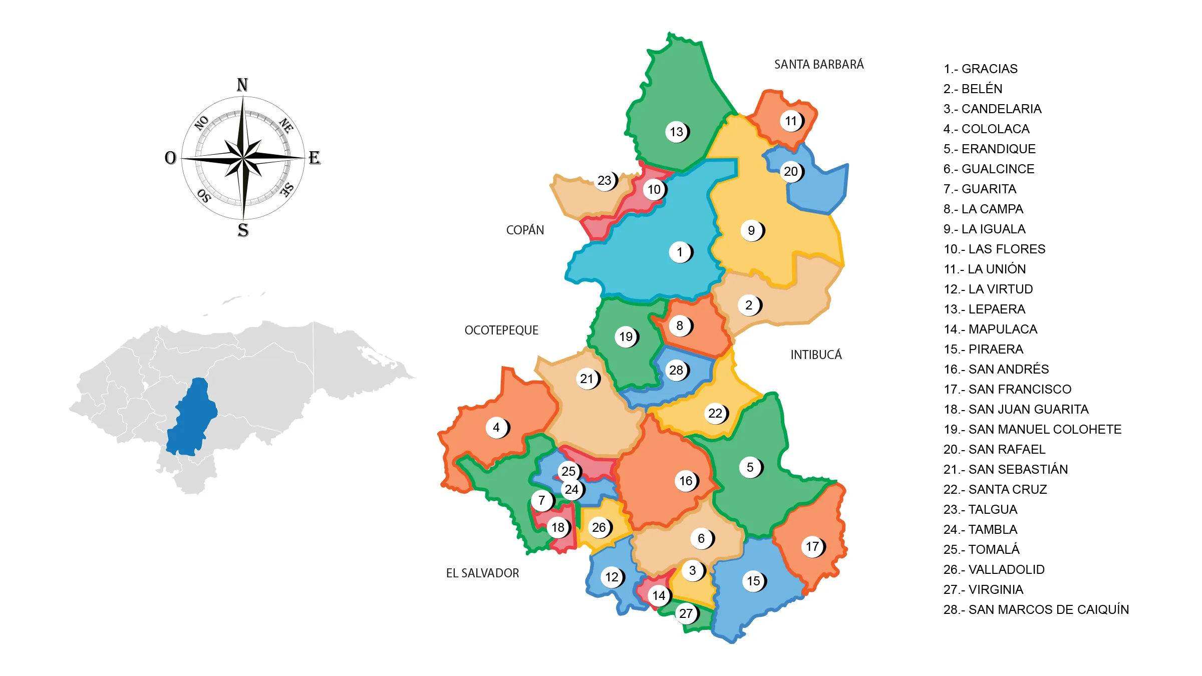
The Lempira Department is located in the west of the country. It has a territorial area of 4,228 km².
Lempira was founded on June 28, 1825. Before, this department belonged to the territory of Gracias as part of the first territorial organization of Honduras in 1536. The name of the department is a tribute to the indigenous hero Lempira originally from this place.
Limits
- North: Department of Santa Bárbara
- South: Republic of El Salvador
- East: Department of Intibucá
- West: Departments of Copán and Ocotepeque.
Municipalities
See List of Municipalities of Honduras
- Gracias 1301 Cabecera Departamental
- Belén 1302
- Candelaria 1303
- Cololaca 1304
- Erandique 1305
- Gualcince 1306
- Guarita 1307
- La Campa 1308
- La Iguala 1309
- Las Flores 1310
- La Unión 1311
- La Virtud 1312
- Lepaera 1313
- Mapulaca 1314
- Piraera 1315
- San Andrés 1316
- San Francisco 1317
- San Juan Guarita 1318
- San Manuel Colohete 1319
- San Rafael 1320
- San Sebastián 1321
- Santa Cruz 1322
- Talgua 1323
- Tambla 1324
- Tomalá 1325
- Valladolid 1326
- Virginia 1327
- San Marcos de Caiquín 1328