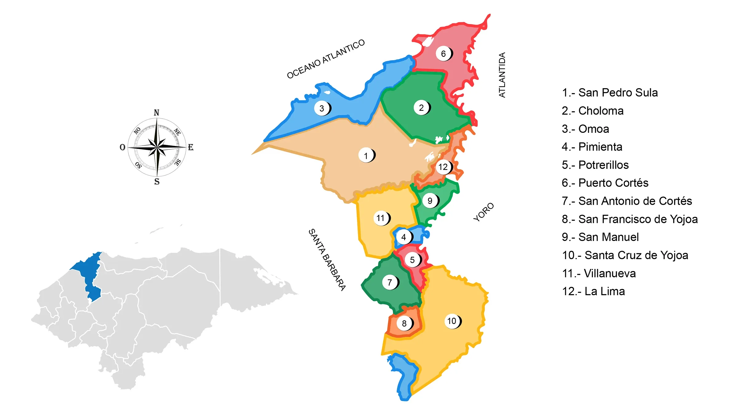
Map of the Department of Cortés

The Department of Cortés is located in the northwestern part of the country. It has a territorial area of 3,911 km2.
Limits:
- North: Sea of the Antilles
- South: Department of Comayagua
- East: Departments of Atlántida and Yoro;
- West: Department of Santa Bárbara and the Republic of Guatemala.
Municipalities of Cortés
See List of Municipalities of Honduras
- San Pedro Sula
- Choloma
- Omoa
- Pimienta
- Potrerillos
- Puerto Cortés
- San Antonio de Cortés
- San Francisco de Yojoa
- San Manuel
- Santa Cruz de Yojoa
- Villanueva
- La Lima


