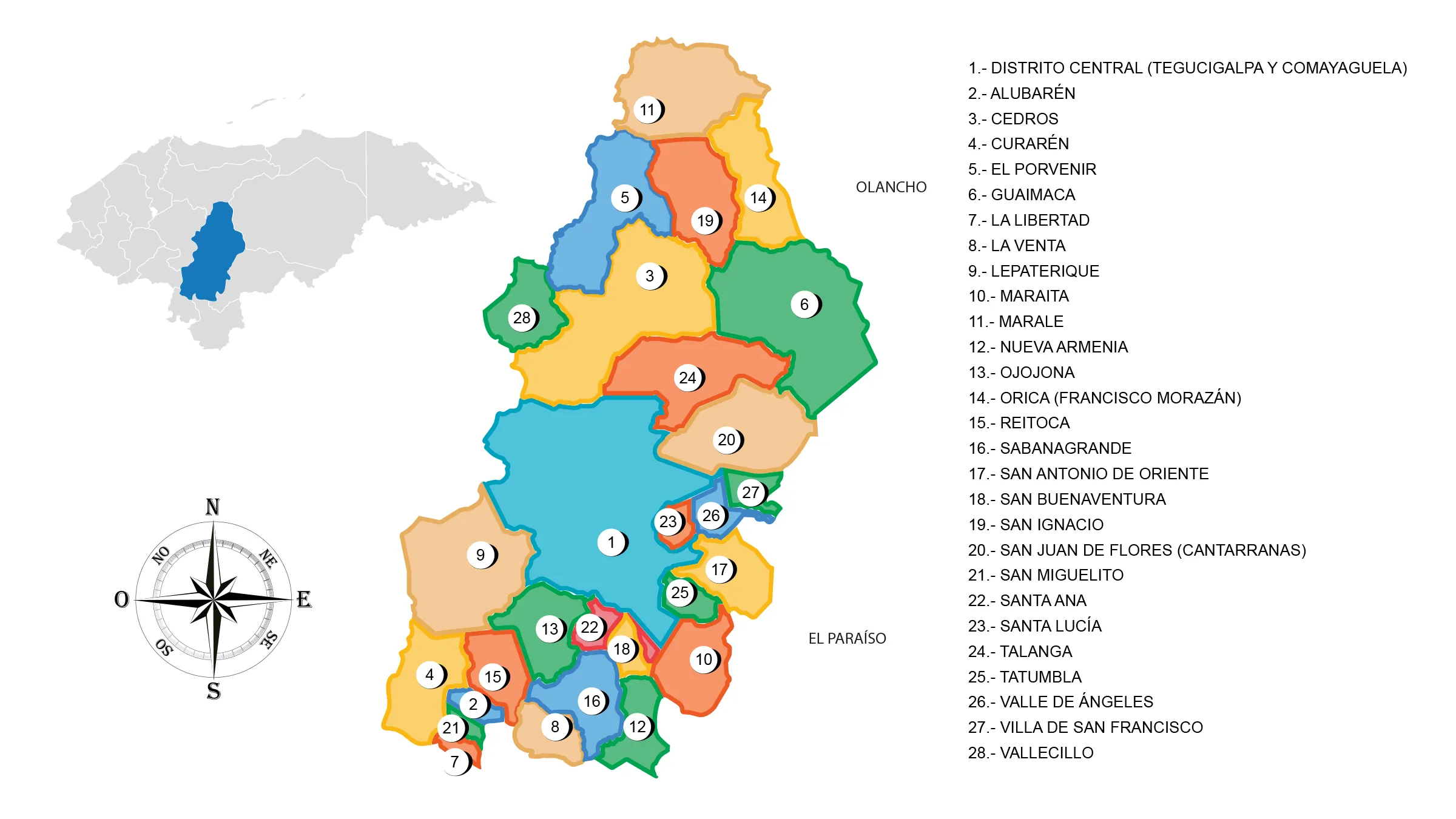
Map of the Department of Francisco Morazán

The Department of Francisco Morazán is located in the central part of the country. It has a territorial area of 8,619 km².
The department was created on June 28, 1825, according to the first constitution of the state of Honduras of that same year. On January 11, 1943, President Tiburcio Carias Andino changed the name to Francisco Morazán.
The city was established as the capital of the state of Honduras on October 30, 1880 by President Marco Aurelio Soto, since that date it became the political center where the three powers of the State reside: Executive, Legislative and Judicial, and it is also an important center for the commercial and industrial development of the country.
Limits
- North: departments of Comayagua, Yoro and Olancho
- South: departments of Valle and Choluteca
- East: department of Olancho and El Paraíso
- West: department of Comayagua and La Paz
Municipios de Francisco Morazán
See List of Municipalities of Honduras
- Distrito Central (Tegucigalpa y Comayaguela)
- Alubarén
- Cedros
- Curarén
- El Porvenir
- Guaimaca
- La Libertad
- La Venta
- Lepaterique
- Maraita
- Marale
- Nueva Armenia
- Ojojona
- Orica (Francisco Morazan)
- Reitoca
- Sabanagrande
- San Antonio de Oriente
- San Buenaventura 0818
- San Ignacio
- San Juan de Flores o como se le conoce Cantarranas
- San Miguelito
- Santa Ana
- Santa Lucía
- Talanga
- Tatumbla
- Valle de Ángeles
- Villa de San Francisco
- Vallecillo


